Werota elevation
Werota (Amhara), Ethiopia elevation is 1810 meters and Werota elevation in feet is 5938 ft above sea level [src 1]. Werota is a populated place (feature code) with elevation that is 86 meters (282 ft) smaller than average city elevation in Ethiopia.
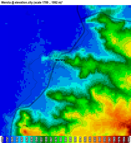
Below is the Elevation map of Werota, which displays elevation range with different colors. Scale of the first map is from 1789 to 1992 m (5869 to 6535 ft) with average elevation of 1836 meters (=6024 ft) [note 1]
These maps also provides idea of topography and contour of this city, they are displayed at different zoom levels. More info about maps, scale and edge coordinates you can find below images.
| \ | Map #1 | Map #2 | Topo.Map |
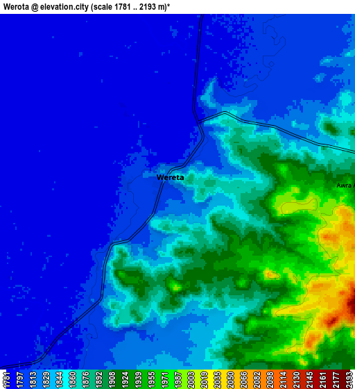
| Scale [m] | 1789..1992 m | 1781..2193 m | × |
| Scale [ft] | 5869..6535 ft | 5843..7195 ft | × |
| Average | 1836 m = 6024 ft | 1843 m = 6047 ft | × |
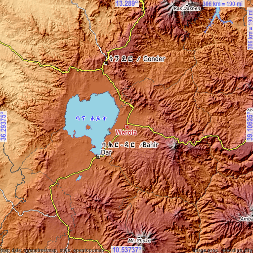
| Width | 9.56 km = 5.9 mi | 19.12 km = 11.9 mi | 306 km = 190.1 mi |
| Height | 9.56 km = 5.9 mi | 19.12 km = 11.9 mi | 306 km = 190.1 mi |
| ↑Max Latitude | 11.959665° | 12.002653° | 13.289° |
| Latitude at center | 11.91667° | 11.91667° | 11.91667° |
| ↓Min Latitude | 11.873668° | 11.83066° | 10.53737° |
| ← Min Longitude | 37.656055° | 37.612109° | 36.29375° |
| Longitude center | 37.7° | 37.7° | 37.7° |
| →Max Longitude | 37.743945° | 37.787891° | 39.10625° |
Nearby cities:
Cities around Werota sort by population:
• Bahir Dar elevation 1799 m
49.2 km,  223°
223°
• Gondar 2201 m
80.1 km,  341°
341°
• Debre Tabor 2692 m
35.2 km,  102°
102°
• Debark’ 2854 m
139.5 km,  8°
8°
• Finote Selam 1914 m
143.3 km,  199°
199°
• Addiet Canna 2203 m
76 km, 198°
• Ādīs Zemen 2023 m
24 km,  22°
22°
• Burē 2058 m
151.9 km,  207°
207°
• Bichena 2544 m
172 km,  161°
161°
• Dabat 2602 m
118.9 km,  3°
3°
• Lalībela 2481 m
147.1 km,  84°
84°
• Debre Werk’ 2513 m
148 km, 159°
Multilingual:
 En español:
Werota elevación 1810 m.
 En France:
Werota élévation 1810 m.


Sources and notes:
- [note 1] Map square and city borders are not equal. Map elevation data is calculated only from area inside that square.
- [src 1] Elevation data from geonames database provided with same terms of usage.
- [src 2] The elevation map of Werota is generated using elevation data from NASA's 3 arcsec (90m) resolution SRTM data.
- [src 3] Base (background) map © OpenStreetMap contributors tiles are generated by Geofabrik and OpenTopoMap.
Copyright & License:
This Werota Elevation Map is licensed under CC BY-SA. You may reuse any part from this page, if you give a proper credit by linking to this URL:
 More info on terms of use page.