Llefià elevation
Llefià (Catalonia, Província de Barcelona), Spain elevation is 23 meters and Llefià elevation in feet is 75 ft above sea level [src 1]. Llefià is a populated place (feature code) with elevation that is 580 meters (1903 ft) smaller than average city elevation in Spain.
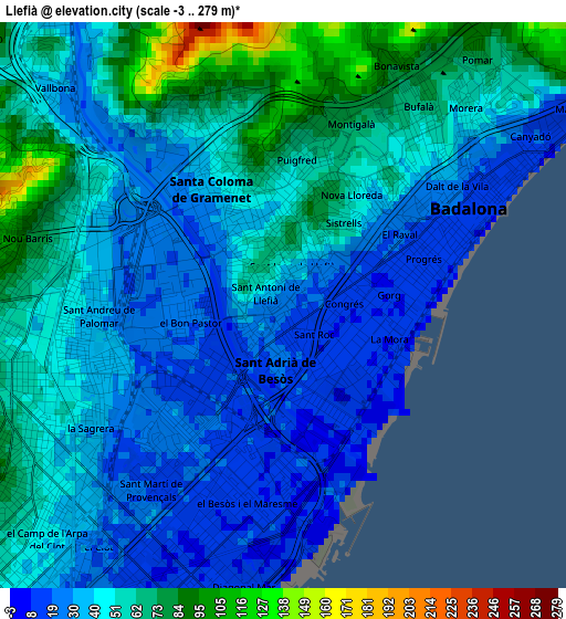
Below is the Elevation map of Llefià, which displays elevation range with different colors. Scale of the first map is from -3 to 279 m (-10 to 915 ft) with average elevation of 45.4 meters (=149 ft) [note 1]
These maps also provides idea of topography and contour of this city, they are displayed at different zoom levels. More info about maps, scale and edge coordinates you can find below images.
| \ | Map #1 | Map #2 | Topo.Map |
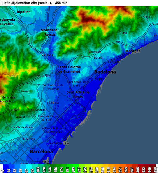
| Scale [m] | -3..279 m | -4..458 m | × |
| Scale [ft] | -10..915 ft | -13..1503 ft | × |
| Average | 45.4 m = 149 ft | 102.4 m = 336 ft | × |
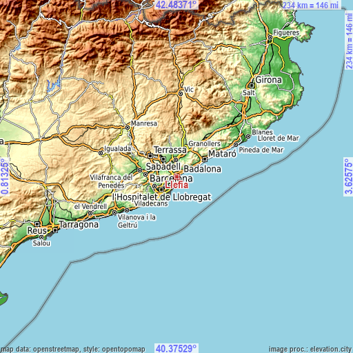
| Width | 7.33 km = 4.6 mi | 14.65 km = 9.1 mi | 234.4 km = 145.6 mi |
| Height | 7.33 km = 4.6 mi | 14.65 km = 9.1 mi | 234.4 km = 145.6 mi |
| ↑Max Latitude | 41.470996° | 41.503916° | 42.48371° |
| Latitude at center | 41.43806° | 41.43806° | 41.43806° |
| ↓Min Latitude | 41.405107° | 41.372137° | 40.37529° |
| ← Min Longitude | 2.175555° | 2.131609° | 0.81325° |
| Longitude center | 2.2195° | 2.2195° | 2.2195° |
| →Max Longitude | 2.263445° | 2.307391° | 3.62575° |
Nearby cities:
Cities around Llefià sort by population:
• Sant Martí elevation 21 m
2.8 km,  217°
217°
• Badalona 16 m
2.7 km,  60°
60°
• Sant Andreu 34 m
2.5 km,  263°
263°
• Santa Coloma de Gramenet 39 m
1.8 km,  327°
327°
• Barri de Sant Andreu 38 m
2.4 km,  267°
267°
• Sant Adrià de Besòs 17 m
0.8 km,  185°
185°
• la Verneda i la Pau 26 m
2.1 km, 221°
• Sant Martí de Provençals 11 m
2.8 km, 224°
• el Besòs i el Maresme 10 m
2.8 km,  183°
183°
• el Bon Pastor 21 m
1.5 km, 265°
• la Trinitat Vella 41 m
2.7 km,  304°
304°
• Baró de Viver 21 m
1.9 km, 296°
Multilingual:
 En español:
Llefià elevación 23 m.
 En France:
Llefià élévation 23 m.


Sources and notes:
- [note 1] Map square and city borders are not equal. Map elevation data is calculated only from area inside that square.
- [src 1] Elevation data from geonames database provided with same terms of usage.
- [src 2] The elevation map of Llefià is generated using elevation data from NASA's 3 arcsec (90m) resolution SRTM data.
- [src 3] Base (background) map © OpenStreetMap contributors tiles are generated by Geofabrik and OpenTopoMap.
Copyright & License:
This Llefià Elevation Map is licensed under CC BY-SA. You may reuse any part from this page, if you give a proper credit by linking to this URL:
 More info on terms of use page.