Port de Pollença elevation
Port de Pollença (Balearic Islands, Illes Balears), Spain elevation is 7 meters and Port de Pollença elevation in feet is 23 ft above sea level [src 1]. Port de Pollença is a populated place (feature code) with elevation that is 596 meters (1955 ft) smaller than average city elevation in Spain.
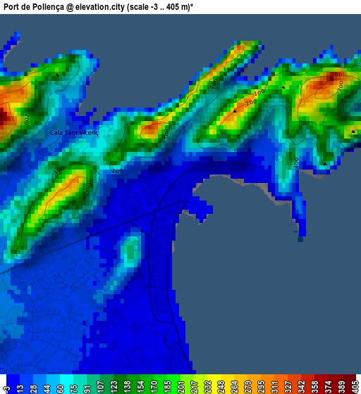
Below is the Elevation map of Port de Pollença, which displays elevation range with different colors. Scale of the first map is from -3 to 405 m (-10 to 1329 ft) with average elevation of 70.2 meters (=230 ft) [note 1]
These maps also provides idea of topography and contour of this city, they are displayed at different zoom levels. More info about maps, scale and edge coordinates you can find below images.
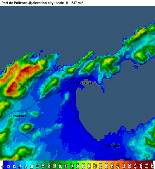
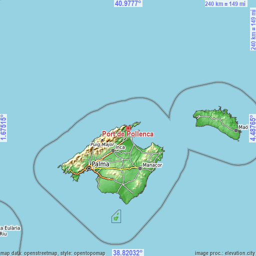
| \ | Map #1 | Map #2 | Topo.Map |
| Scale [m] | -3..405 m | -9..537 m | × |
| Scale [ft] | -10..1329 ft | -30..1762 ft | × |
| Average | 70.2 m = 230 ft | 89.7 m = 294 ft | × |
| Width | 7.5 km = 4.7 mi | 14.99 km = 9.3 mi | 239.9 km = 149.1 mi |
| Height | 7.5 km = 4.7 mi | 14.99 km = 9.3 mi | 239.9 km = 149.1 mi |
| ↑Max Latitude | 39.941201° | 39.974886° | 40.9777° |
| Latitude at center | 39.9075° | 39.9075° | 39.9075° |
| ↓Min Latitude | 39.873782° | 39.840048° | 38.82032° |
| ← Min Longitude | 3.037455° | 2.993509° | 1.67515° |
| Longitude center | 3.0814° | 3.0814° | 3.0814° |
| →Max Longitude | 3.125345° | 3.169291° | 4.48765° |
Nearby cities:
Cities around Port de Pollença sort by population:
• Alcúdia elevation 19 m
6.9 km,  150°
150°
• Pollença 47 m
6.5 km,  238°
238°
• sa Pobla 29 m
16.1 km,  197°
197°
• Santa Margalida 88 m
23 km,  175°
175°
• Can Picafort 6 m
17 km,  158°
158°
• Muro 72 m
19.1 km,  186°
186°
• Port d'Alcúdia 7 m
8.5 km, 148°
• Selva 198 m
22.9 km,  222°
222°
• Campanet 132 m
17.8 km,  213°
213°
• Llubí 56 m
24 km, 195°
• Búger 91 m
18.6 km, 206°
• Escorca 682 m
20.5 km, 242°
Multilingual:
 En español:
Port de Pollença elevación 7 m.
 En France:
Port de Pollença élévation 7 m.
 Auf Deutsch:
Port de Pollença höhe über dem Meeresspiegel ist 7 m.

Sources and notes:
- [note 1] Map square and city borders are not equal. Map elevation data is calculated only from area inside that square.
- [src 1] Elevation data from geonames database provided with same terms of usage.
- [src 2] The elevation map of Port de Pollença is generated using elevation data from NASA's 3 arcsec (90m) resolution SRTM data.
- [src 3] Base (background) map © OpenStreetMap contributors tiles are generated by Geofabrik and OpenTopoMap.
Copyright & License:
This Port de Pollença Elevation Map is licensed under CC BY-SA. You may reuse any part from this page, if you give a proper credit by linking to this URL:
 More info on terms of use page.