Abades elevation
Abades (Castille and León, Provincia de Segovia), Spain elevation is 970 meters and Abades elevation in feet is 3182 ft above sea level [src 1]. Abades is a seat of a third-order administrative division (feature code) with elevation that is 367 meters (1204 ft) bigger than average city elevation in Spain.
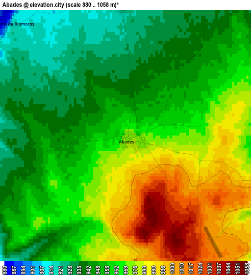
Below is the Elevation map of Abades, which displays elevation range with different colors. Scale of the first map is from 880 to 1058 m (2887 to 3471 ft) with average elevation of 961.3 meters (=3154 ft) [note 1]
These maps also provides idea of topography and contour of this city, they are displayed at different zoom levels. More info about maps, scale and edge coordinates you can find below images.
| \ | Map #1 | Topo.Map |
| Scale [m] | 880..1058 m | × |
| Scale [ft] | 2887..3471 ft | × |
| Average | 961.3 m = 3154 ft | × |
| Width | 7.38 km = 4.6 mi | 236.3 km = 146.8 mi |
| Height | 7.38 km = 4.6 mi | 236.3 km = 146.8 mi |
| ↑Max Latitude | 40.94966° | 41.97056° |
| Latitude at center | 40.91646° | 40.91646° |
| ↓Min Latitude | 40.883244° | 39.84528° |
| ← Min Longitude | -4.313315° | -5.67562° |
| Longitude center | -4.26937° | -4.26937° |
| →Max Longitude | -4.225425° | -2.86312° |
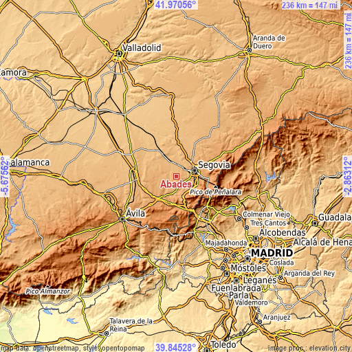
Nearby cities:
Cities around Abades sort by population:
• Valverde del Majano elevation 925 m
5.4 km,  32°
32°
• Marugán 952 m
9.8 km,  258°
258°
• Ortigosa del Monte 1104 m
11.4 km,  136°
136°
• Garcillán 917 m
6.8 km,  2°
2°
• Hontanares de Eresma 880 m
9.2 km,  36°
36°
• Martín Miguel 921 m
4 km,  357°
357°
• Anaya 891 m
9 km,  338°
338°
• Marazoleja 913 m
7.6 km,  310°
310°
• Lastras del Pozo 973 m
7.7 km,  237°
237°
• Monterrubio 944 m
10.1 km,  222°
222°
• Valdeprados 988 m
11 km,  174°
174°
• Marazuela 910 m
10.6 km, 310°
Multilingual:
 En español:
Abades elevación 970 m.
 En France:
Abades élévation 970 m.


Sources and notes:
- [note 1] Map square and city borders are not equal. Map elevation data is calculated only from area inside that square.
- [src 1] Elevation data from geonames database provided with same terms of usage.
- [src 2] The elevation map of Abades is generated using elevation data from NASA's 3 arcsec (90m) resolution SRTM data.
- [src 3] Base (background) map © OpenStreetMap contributors tiles are generated by Geofabrik and OpenTopoMap.
Copyright & License:
This Abades Elevation Map is licensed under CC BY-SA. You may reuse any part from this page, if you give a proper credit by linking to this URL:
 More info on terms of use page.