Arellano elevation
Arellano (Navarre, Provincia de Navarra), Spain elevation is 644 meters and Arellano elevation in feet is 2113 ft above sea level [src 1]. Arellano is a seat of a third-order administrative division (feature code) with elevation that is 41 meters (135 ft) bigger than average city elevation in Spain.
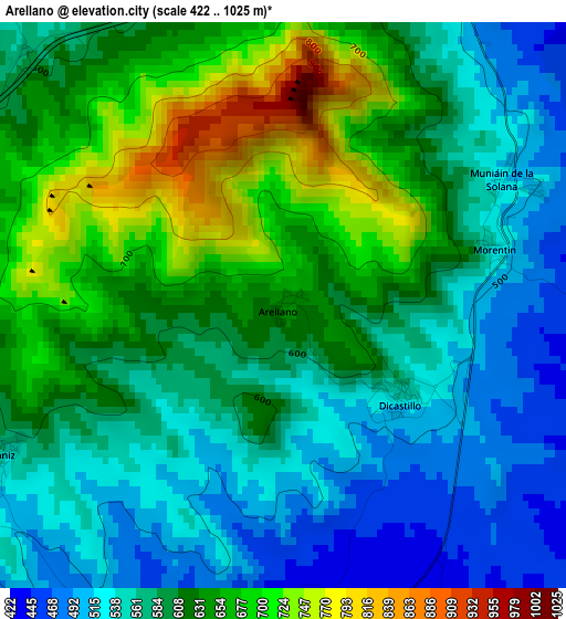
Below is the Elevation map of Arellano, which displays elevation range with different colors. Scale of the first map is from 422 to 1025 m (1385 to 3363 ft) with average elevation of 602.7 meters (=1977 ft) [note 1]
These maps also provides idea of topography and contour of this city, they are displayed at different zoom levels. More info about maps, scale and edge coordinates you can find below images.
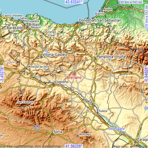
| \ | Map #1 | Topo.Map |
| Scale [m] | 422..1025 m | × |
| Scale [ft] | 1385..3363 ft | × |
| Average | 602.7 m = 1977 ft | × |
| Width | 7.19 km = 4.5 mi | 230.2 km = 143 mi |
| Height | 7.19 km = 4.5 mi | 230.2 km = 143 mi |
| ↑Max Latitude | 42.638317° | 43.63241° |
| Latitude at center | 42.60598° | 42.60598° |
| ↓Min Latitude | 42.573627° | 41.56235° |
| ← Min Longitude | -2.090475° | -3.45278° |
| Longitude center | -2.04653° | -2.04653° |
| →Max Longitude | -2.002585° | -0.64028° |
Nearby cities:
Cities around Arellano sort by population:
• Estella-Lizarra elevation 430 m
7.4 km,  9°
9°
• Ayegui 493 m
5.7 km, 5°
• Arróniz 546 m
4.2 km,  242°
242°
• Allo 425 m
4.8 km,  153°
153°
• Villatuerta 428 m
7.5 km,  36°
36°
• Dicastillo 532 m
1.9 km,  123°
123°
• Igúzquiza 515 m
5.4 km,  323°
323°
• Morentin 537 m
2.8 km,  73°
73°
• Villamayor de Monjardín 680 m
5.4 km,  298°
298°
• Etayo 595 m
8.9 km,  277°
277°
• Olejua 574 m
8 km, 283°
• Oteiza 510 m
7.7 km,  79°
79°
Multilingual:
 En español:
Arellano elevación 644 m.
 En France:
Arellano élévation 644 m.
 Auf Deutsch:
Arellano höhe über dem Meeresspiegel ist 644 m.

Sources and notes:
- [note 1] Map square and city borders are not equal. Map elevation data is calculated only from area inside that square.
- [src 1] Elevation data from geonames database provided with same terms of usage.
- [src 2] The elevation map of Arellano is generated using elevation data from NASA's 3 arcsec (90m) resolution SRTM data.
- [src 3] Base (background) map © OpenStreetMap contributors tiles are generated by Geofabrik and OpenTopoMap.
Copyright & License:
This Arellano Elevation Map is licensed under CC BY-SA. You may reuse any part from this page, if you give a proper credit by linking to this URL:
 More info on terms of use page.