Benavente elevation
Benavente (Castille and León, Provincia de Zamora), Spain elevation is 750 meters and Benavente elevation in feet is 2461 ft above sea level [src 1]. Benavente is a seat of a third-order administrative division (feature code) with elevation that is 147 meters (482 ft) bigger than average city elevation in Spain.
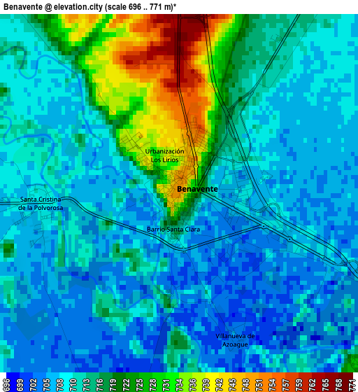
Below is the Elevation map of Benavente, which displays elevation range with different colors. Scale of the first map is from 696 to 771 m (2283 to 2530 ft) with average elevation of 713.3 meters (=2340 ft) [note 1]
These maps also provides idea of topography and contour of this city, they are displayed at different zoom levels. More info about maps, scale and edge coordinates you can find below images.
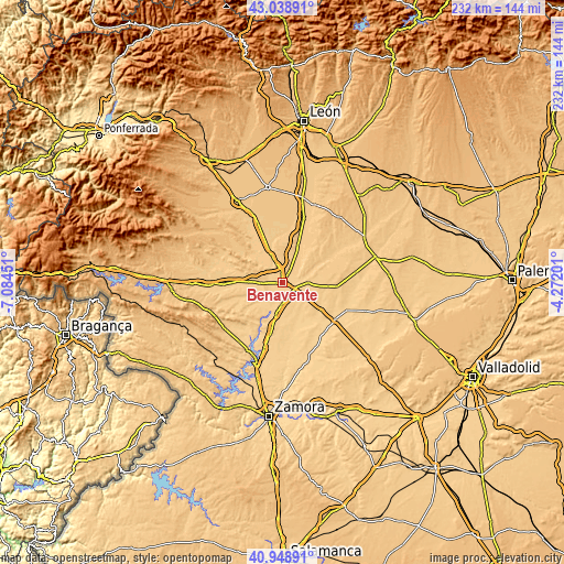
| \ | Map #1 | Map #2 | Topo.Map |
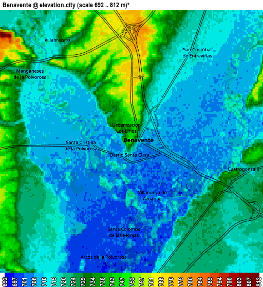
| Scale [m] | 696..771 m | 692..812 m | × |
| Scale [ft] | 2283..2530 ft | 2270..2664 ft | × |
| Average | 713.3 m = 2340 ft | 719.7 m = 2361 ft | × |
| Width | 7.26 km = 4.5 mi | 14.52 km = 9 mi | 232.4 km = 144.4 mi |
| Height | 7.26 km = 4.5 mi | 14.52 km = 9 mi | 232.4 km = 144.4 mi |
| ↑Max Latitude | 42.035138° | 42.067769° | 43.03891° |
| Latitude at center | 42.00249° | 42.00249° | 42.00249° |
| ↓Min Latitude | 41.969825° | 41.937144° | 40.94891° |
| ← Min Longitude | -5.722205° | -5.766151° | -7.08451° |
| Longitude center | -5.67826° | -5.67826° | -5.67826° |
| →Max Longitude | -5.634315° | -5.590369° | -4.27201° |
Nearby cities:
Cities around Benavente sort by population:
• San Cristóbal de Entreviñas elevation 716 m
6 km,  36°
36°
• Santa Cristina de la Polvorosa 709 m
2.9 km,  264°
264°
• Manganeses de la Polvorosa 717 m
6.8 km,  303°
303°
• Castrogonzalo 724 m
6.3 km,  101°
101°
• Villabrázaro 729 m
7 km,  324°
324°
• Villanázar 707 m
9 km,  249°
249°
• Santa Colomba de las Monjas 703 m
4.9 km,  185°
185°
• Villanueva de Azoague 703 m
3.2 km,  158°
158°
• Barcial del Barco 716 m
7.8 km,  170°
170°
• Arcos de la Polvorosa 703 m
6.7 km, 193°
• Milles de la Polvorosa 704 m
9.9 km,  207°
207°
• Villaveza del Agua 708 m
9.3 km,  180°
180°
Multilingual:
 En español:
Benavente elevación 750 m.
 En France:
Benavente élévation 750 m.
 Auf Deutsch:
Benavente höhe über dem Meeresspiegel ist 750 m.

Sources and notes:
- [note 1] Map square and city borders are not equal. Map elevation data is calculated only from area inside that square.
- [src 1] Elevation data from geonames database provided with same terms of usage.
- [src 2] The elevation map of Benavente is generated using elevation data from NASA's 3 arcsec (90m) resolution SRTM data.
- [src 3] Base (background) map © OpenStreetMap contributors tiles are generated by Geofabrik and OpenTopoMap.
Copyright & License:
This Benavente Elevation Map is licensed under CC BY-SA. You may reuse any part from this page, if you give a proper credit by linking to this URL:
 More info on terms of use page.