Cantalapiedra elevation
Cantalapiedra (Castille and León, Provincia de Salamanca), Spain elevation is 784 meters and Cantalapiedra elevation in feet is 2572 ft above sea level [src 1]. Cantalapiedra is a seat of a third-order administrative division (feature code) with elevation that is 181 meters (594 ft) bigger than average city elevation in Spain.
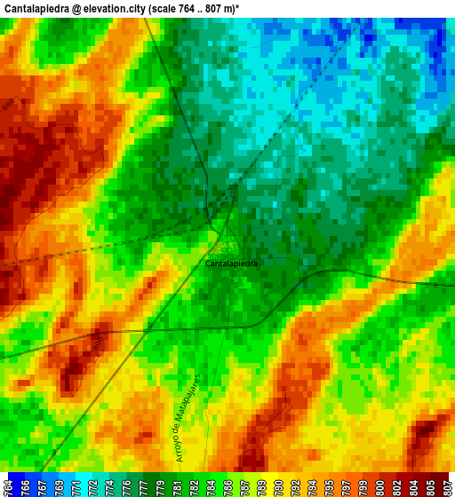
Below is the Elevation map of Cantalapiedra, which displays elevation range with different colors. Scale of the first map is from 764 to 807 m (2507 to 2648 ft) with average elevation of 785.3 meters (=2576 ft) [note 1]
These maps also provides idea of topography and contour of this city, they are displayed at different zoom levels. More info about maps, scale and edge coordinates you can find below images.
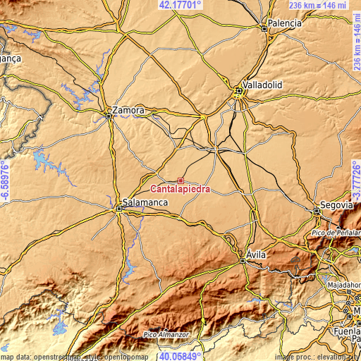
| \ | Map #1 | Topo.Map |
| Scale [m] | 764..807 m | × |
| Scale [ft] | 2507..2648 ft | × |
| Average | 785.3 m = 2576 ft | × |
| Width | 7.36 km = 4.6 mi | 235.6 km = 146.4 mi |
| Height | 7.36 km = 4.6 mi | 235.6 km = 146.4 mi |
| ↑Max Latitude | 41.159394° | 42.17701° |
| Latitude at center | 41.1263° | 41.1263° |
| ↓Min Latitude | 41.093189° | 40.05849° |
| ← Min Longitude | -5.227455° | -6.58976° |
| Longitude center | -5.18351° | -5.18351° |
| →Max Longitude | -5.139565° | -3.77726° |
Nearby cities:
Cities around Cantalapiedra sort by population:
• Fresno El Viejo elevation 759 m
8.6 km,  22°
22°
• Cantalpino 809 m
14.7 km,  236°
236°
• Horcajo de las Torres 819 m
10.3 km,  131°
131°
• Palaciosrubios 808 m
8.3 km,  186°
186°
• Tarazona de Guareña 771 m
7.5 km,  312°
312°
• Villaflores 796 m
6.3 km,  222°
222°
• Torrecilla de la Orden 779 m
10.8 km,  341°
341°
• Poveda de las Cintas 821 m
11 km, 215°
• Rasueros 833 m
14.7 km,  141°
141°
• Zorita de la Frontera 831 m
12.5 km, 185°
• Carpio 771 m
11.5 km,  32°
32°
• Vallesa de la Guareña 771 m
12 km,  274°
274°
Multilingual:
 En español:
Cantalapiedra elevación 784 m.
 En France:
Cantalapiedra élévation 784 m.
 Auf Deutsch:
Cantalapiedra höhe über dem Meeresspiegel ist 784 m.

Sources and notes:
- [note 1] Map square and city borders are not equal. Map elevation data is calculated only from area inside that square.
- [src 1] Elevation data from geonames database provided with same terms of usage.
- [src 2] The elevation map of Cantalapiedra is generated using elevation data from NASA's 3 arcsec (90m) resolution SRTM data.
- [src 3] Base (background) map © OpenStreetMap contributors tiles are generated by Geofabrik and OpenTopoMap.
Copyright & License:
This Cantalapiedra Elevation Map is licensed under CC BY-SA. You may reuse any part from this page, if you give a proper credit by linking to this URL:
 More info on terms of use page.