Cariño elevation
Cariño (Galicia, Provincia da Coruña), Spain elevation is 22 meters and Cariño elevation in feet is 72 ft above sea level [src 1]. Cariño is a seat of a third-order administrative division (feature code) with elevation that is 581 meters (1906 ft) smaller than average city elevation in Spain.
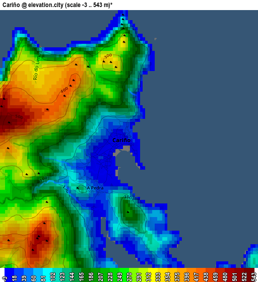
Below is the Elevation map of Cariño, which displays elevation range with different colors. Scale of the first map is from -3 to 543 m (-10 to 1781 ft) with average elevation of 202.6 meters (=665 ft) [note 1]
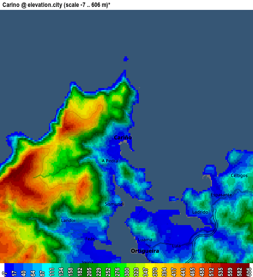
These maps also provides idea of topography and contour of this city, they are displayed at different zoom levels. More info about maps, scale and edge coordinates you can find below images.
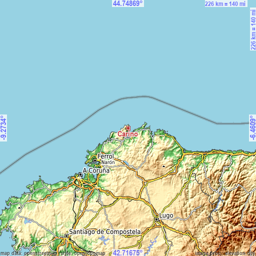
| \ | Map #1 | Map #2 | Topo.Map |
| Scale [m] | -3..543 m | -7..606 m | × |
| Scale [ft] | -10..1781 ft | -23..1988 ft | × |
| Average | 202.6 m = 665 ft | 190.9 m = 626 ft | × |
| Width | 7.06 km = 4.4 mi | 14.12 km = 8.8 mi | 225.9 km = 140.4 mi |
| Height | 7.06 km = 4.4 mi | 14.12 km = 8.8 mi | 225.9 km = 140.4 mi |
| ↑Max Latitude | 43.773081° | 43.804805° | 44.74869° |
| Latitude at center | 43.74134° | 43.74134° | 43.74134° |
| ↓Min Latitude | 43.709582° | 43.677808° | 42.71675° |
| ← Min Longitude | -7.911095° | -7.955041° | -9.2734° |
| Longitude center | -7.86715° | -7.86715° | -7.86715° |
| →Max Longitude | -7.823205° | -7.779259° | -6.4609° |
Nearby cities:
Cities around Cariño sort by population:
• Viveiro elevation 26 m
23.7 km,  111°
111°
• As Pontes de García Rodríguez 361 m
32.1 km,  177°
177°
• Santa Marta de Ortigueira 37 m
6.6 km,  167°
167°
• Cedeira 21 m
17.7 km,  239°
239°
• Valdoviño 161 m
26.6 km,  233°
233°
• Cerdido 157 m
17.1 km,  218°
218°
• Moeche 190 m
24.4 km,  209°
209°
• Somozas 265 m
23.7 km,  192°
192°
• Muras 470 m
32.6 km,  159°
159°
• Xove 56 m
29.2 km,  102°
102°
• San Sadurniño 101 m
28.2 km, 214°
• Mañón 297 m
14.8 km,  133°
133°
Multilingual:
 En español:
Cariño elevación 22 m.
 En France:
Cariño élévation 22 m.


Sources and notes:
- [note 1] Map square and city borders are not equal. Map elevation data is calculated only from area inside that square.
- [src 1] Elevation data from geonames database provided with same terms of usage.
- [src 2] The elevation map of Cariño is generated using elevation data from NASA's 3 arcsec (90m) resolution SRTM data.
- [src 3] Base (background) map © OpenStreetMap contributors tiles are generated by Geofabrik and OpenTopoMap.
Copyright & License:
This Cariño Elevation Map is licensed under CC BY-SA. You may reuse any part from this page, if you give a proper credit by linking to this URL:
 More info on terms of use page.