Contamina elevation
Contamina (Aragon, Provincia de Zaragoza), Spain elevation is 667 meters and Contamina elevation in feet is 2188 ft above sea level [src 1]. Contamina is a seat of a third-order administrative division (feature code) with elevation that is 64 meters (210 ft) bigger than average city elevation in Spain.
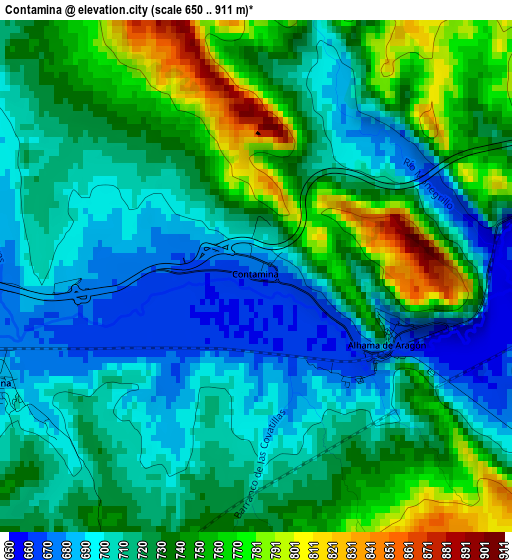
Below is the Elevation map of Contamina, which displays elevation range with different colors. Scale of the first map is from 650 to 911 m (2133 to 2989 ft) with average elevation of 725.3 meters (=2380 ft) [note 1]
These maps also provides idea of topography and contour of this city, they are displayed at different zoom levels. More info about maps, scale and edge coordinates you can find below images.
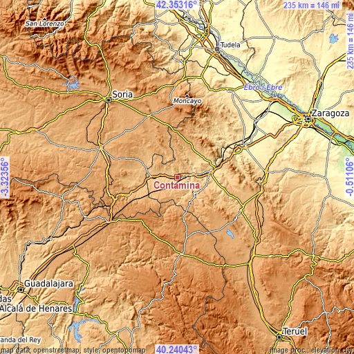
| \ | Map #1 | Topo.Map |
| Scale [m] | 650..911 m | × |
| Scale [ft] | 2133..2989 ft | × |
| Average | 725.3 m = 2380 ft | × |
| Width | 7.34 km = 4.6 mi | 234.9 km = 146 mi |
| Height | 7.34 km = 4.6 mi | 234.9 km = 146 mi |
| ↑Max Latitude | 41.338353° | 42.35316° |
| Latitude at center | 41.30535° | 41.30535° |
| ↓Min Latitude | 41.27233° | 40.24043° |
| ← Min Longitude | -1.961255° | -3.32356° |
| Longitude center | -1.91731° | -1.91731° |
| →Max Longitude | -1.873365° | -0.51106° |
Nearby cities:
Cities around Contamina sort by population:
• Ateca elevation 600 m
10.7 km,  74°
74°
• Ariza 721 m
11.4 km,  275°
275°
• Alhama de Aragón 662 m
2.2 km,  116°
116°
• Cetina 686 m
4.1 km,  248°
248°
• Ibdes 724 m
12.1 km,  144°
144°
• Moros 704 m
12.7 km,  35°
35°
• Jaraba 762 m
13 km,  167°
167°
• Carenas 658 m
10.5 km,  107°
107°
• Castejón de las Armas 610 m
8.9 km,  86°
86°
• Bubierca 662 m
5.4 km,  78°
78°
• Embid de Ariza 768 m
9.4 km,  329°
329°
• Godojos 766 m
6.1 km,  132°
132°
Multilingual:
 En español:
Contamina elevación 667 m.
 En France:
Contamina élévation 667 m.
 Auf Deutsch:
Contamina höhe über dem Meeresspiegel ist 667 m.

Sources and notes:
- [note 1] Map square and city borders are not equal. Map elevation data is calculated only from area inside that square.
- [src 1] Elevation data from geonames database provided with same terms of usage.
- [src 2] The elevation map of Contamina is generated using elevation data from NASA's 3 arcsec (90m) resolution SRTM data.
- [src 3] Base (background) map © OpenStreetMap contributors tiles are generated by Geofabrik and OpenTopoMap.
Copyright & License:
This Contamina Elevation Map is licensed under CC BY-SA. You may reuse any part from this page, if you give a proper credit by linking to this URL:
 More info on terms of use page.