Corrales elevation
Corrales (Castille and León, Provincia de Zamora), Spain elevation is 765 meters and Corrales elevation in feet is 2510 ft above sea level [src 1]. Corrales is a seat of a third-order administrative division (feature code) with elevation that is 162 meters (531 ft) bigger than average city elevation in Spain.
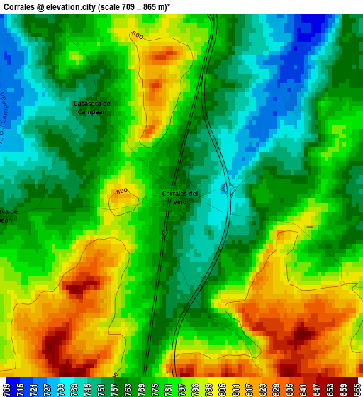
Below is the Elevation map of Corrales, which displays elevation range with different colors. Scale of the first map is from 709 to 865 m (2326 to 2838 ft) with average elevation of 776.2 meters (=2547 ft) [note 1]
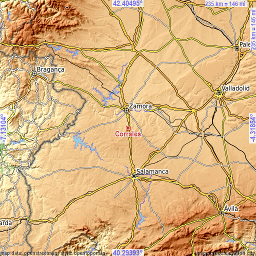
These maps also provides idea of topography and contour of this city, they are displayed at different zoom levels. More info about maps, scale and edge coordinates you can find below images.
| \ | Map #1 | Topo.Map |
| Scale [m] | 709..865 m | × |
| Scale [ft] | 2326..2838 ft | × |
| Average | 776.2 m = 2547 ft | × |
| Width | 7.34 km = 4.6 mi | 234.7 km = 145.8 mi |
| Height | 7.34 km = 4.6 mi | 234.7 km = 145.8 mi |
| ↑Max Latitude | 41.390977° | 42.40495° |
| Latitude at center | 41.358° | 41.358° |
| ↓Min Latitude | 41.325006° | 40.29393° |
| ← Min Longitude | -5.768735° | -7.13104° |
| Longitude center | -5.72479° | -5.72479° |
| →Max Longitude | -5.680845° | -4.31854° |
Nearby cities:
Cities around Corrales sort by population:
• Casaseca de las Chanas elevation 710 m
9.9 km,  24°
24°
• Fuentespreadas 765 m
8.8 km,  113°
113°
• Gema 713 m
9.2 km,  43°
43°
• Peleas de Abajo 715 m
4.8 km, 37°
• Santa Clara de Avedillo 772 m
4.5 km,  118°
118°
• Jambrina 706 m
6.3 km,  53°
53°
• Cabañas de Sayago 794 m
5.6 km,  240°
240°
• Villanueva de Campeán 760 m
3.8 km,  264°
264°
• Entrala 704 m
8.4 km,  342°
342°
• Cuelgamures 802 m
7.9 km,  135°
135°
• Casaseca de Campeán 764 m
2.6 km,  315°
315°
• Cazurra 727 m
6.6 km,  14°
14°
Multilingual:
 En español:
Corrales elevación 765 m.
 En France:
Corrales élévation 765 m.
 Auf Deutsch:
Corrales höhe über dem Meeresspiegel ist 765 m.

Sources and notes:
- [note 1] Map square and city borders are not equal. Map elevation data is calculated only from area inside that square.
- [src 1] Elevation data from geonames database provided with same terms of usage.
- [src 2] The elevation map of Corrales is generated using elevation data from NASA's 3 arcsec (90m) resolution SRTM data.
- [src 3] Base (background) map © OpenStreetMap contributors tiles are generated by Geofabrik and OpenTopoMap.
Copyright & License:
This Corrales Elevation Map is licensed under CC BY-SA. You may reuse any part from this page, if you give a proper credit by linking to this URL:
 More info on terms of use page.