Fene elevation
Fene (Galicia, Provincia da Coruña), Spain elevation is 274 meters and Fene elevation in feet is 899 ft above sea level [src 1]. Fene is a seat of a third-order administrative division (feature code) with elevation that is 329 meters (1079 ft) smaller than average city elevation in Spain.
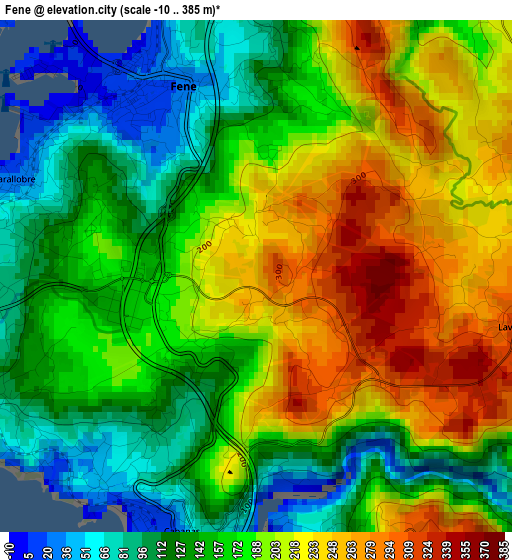
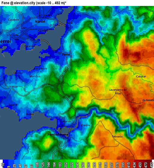
Below is the Elevation map of Fene, which displays elevation range with different colors. Scale of the first map is from -10 to 385 m (-33 to 1263 ft) with average elevation of 177.9 meters (=584 ft) [note 1]
These maps also provides idea of topography and contour of this city, they are displayed at different zoom levels. More info about maps, scale and edge coordinates you can find below images.
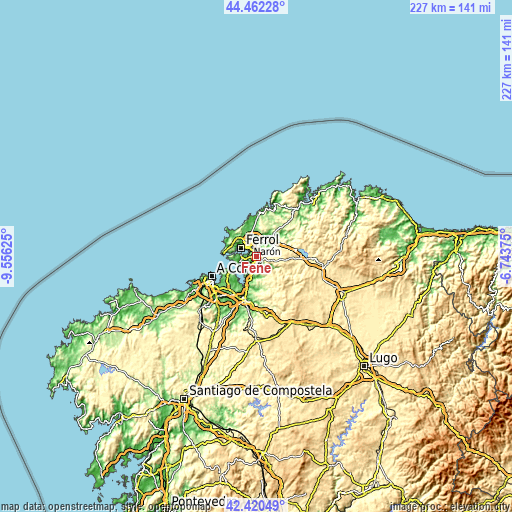
| \ | Map #1 | Map #2 | Topo.Map |
| Scale [m] | -10..385 m | -10..492 m | × |
| Scale [ft] | -33..1263 ft | -33..1614 ft | × |
| Average | 177.9 m = 584 ft | 175.9 m = 577 ft | × |
| Width | 7.09 km = 4.4 mi | 14.19 km = 8.8 mi | 227 km = 141.1 mi |
| Height | 7.09 km = 4.4 mi | 14.19 km = 8.8 mi | 227 km = 141.1 mi |
| ↑Max Latitude | 43.481895° | 43.513773° | 44.46228° |
| Latitude at center | 43.45° | 43.45° | 43.45° |
| ↓Min Latitude | 43.418088° | 43.38616° | 42.42049° |
| ← Min Longitude | -8.193945° | -8.237891° | -9.55625° |
| Longitude center | -8.15° | -8.15° | -8.15° |
| →Max Longitude | -8.106055° | -8.062109° | -6.74375° |
Nearby cities:
Cities around Fene sort by population:
• Ferrol elevation 28 m
7.1 km,  308°
308°
• Narón 23 m
6.6 km,  330°
330°
• Sada 44 m
13.6 km,  219°
219°
• Valdoviño 161 m
16.7 km,  4°
4°
• Bergondo 113 m
16.3 km,  204°
204°
• Mugardos 27 m
8.6 km,  277°
277°
• Ares 6 m
7.8 km,  253°
253°
• Miño 40 m
11.8 km, 199°
• Monfero 448 m
16.9 km,  140°
140°
• Moeche 190 m
15.5 km,  44°
44°
• Paderne 158 m
18.4 km,  186°
186°
• San Sadurniño 101 m
11.4 km, 35°
Multilingual:
 En español:
Fene elevación 274 m.
 En France:
Fene élévation 274 m.


Sources and notes:
- [note 1] Map square and city borders are not equal. Map elevation data is calculated only from area inside that square.
- [src 1] Elevation data from geonames database provided with same terms of usage.
- [src 2] The elevation map of Fene is generated using elevation data from NASA's 3 arcsec (90m) resolution SRTM data.
- [src 3] Base (background) map © OpenStreetMap contributors tiles are generated by Geofabrik and OpenTopoMap.
Copyright & License:
This Fene Elevation Map is licensed under CC BY-SA. You may reuse any part from this page, if you give a proper credit by linking to this URL:
 More info on terms of use page.