Gamonal elevation
Gamonal (Castille and León, Provincia de Burgos), Spain elevation is 867 meters and Gamonal elevation in feet is 2844 ft above sea level [src 1]. Gamonal is a section of populated place (feature code) with elevation that is 264 meters (866 ft) bigger than average city elevation in Spain.
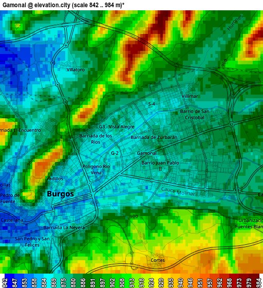
Below is the Elevation map of Gamonal, which displays elevation range with different colors. Scale of the first map is from 842 to 984 m (2762 to 3228 ft) with average elevation of 889.3 meters (=2918 ft) [note 1]
These maps also provides idea of topography and contour of this city, they are displayed at different zoom levels. More info about maps, scale and edge coordinates you can find below images.
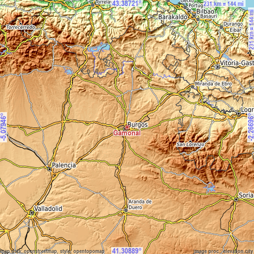
| \ | Map #1 | Map #2 | Topo.Map |
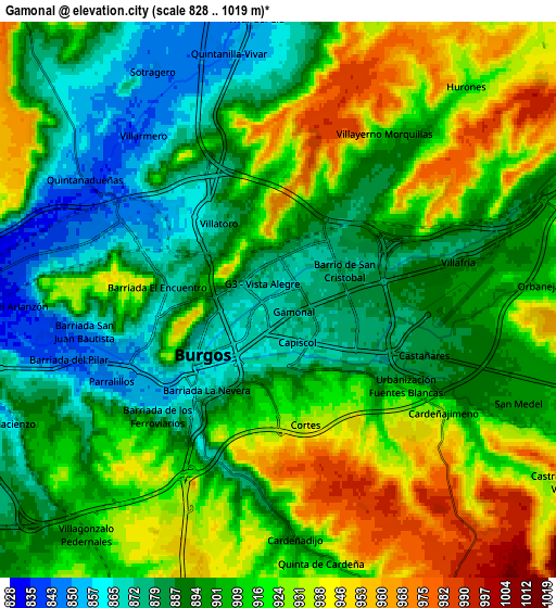
| Scale [m] | 842..984 m | 828..1019 m | × |
| Scale [ft] | 2762..3228 ft | 2717..3343 ft | × |
| Average | 889.3 m = 2918 ft | 907 m = 2976 ft | × |
| Width | 7.22 km = 4.5 mi | 14.44 km = 9 mi | 231.1 km = 143.6 mi |
| Height | 7.22 km = 4.5 mi | 14.44 km = 9 mi | 231.1 km = 143.6 mi |
| ↑Max Latitude | 42.389106° | 42.421555° | 43.38721° |
| Latitude at center | 42.35664° | 42.35664° | 42.35664° |
| ↓Min Latitude | 42.324158° | 42.291658° | 41.30889° |
| ← Min Longitude | -3.717155° | -3.761101° | -5.07946° |
| Longitude center | -3.67321° | -3.67321° | -3.67321° |
| →Max Longitude | -3.629265° | -3.585319° | -2.26696° |
Nearby cities:
Cities around Gamonal sort by population:
• Burgos elevation 863 m
2.9 km,  233°
233°
• Villagonzalo-Pedernales 901 m
8 km,  219°
219°
• Villalbilla de Burgos 834 m
8.9 km,  263°
263°
• Cardeñadijo 911 m
6.1 km,  175°
175°
• Cardeñajimeno 926 m
5.2 km,  124°
124°
• Castrillo del Val 941 m
8.7 km, 123°
• San Mamés de Burgos 843 m
10.2 km, 257°
• Carcedo de Burgos 991 m
8.8 km,  151°
151°
• Sotragero 849 m
6.8 km,  331°
331°
• Rubena 904 m
8.8 km,  67°
67°
• Quintanaortuño 866 m
10.4 km,  355°
355°
• Hurones 923 m
7.2 km,  40°
40°
Multilingual:
 En español:
Gamonal de Ríopico, Gamonal elevación 867 m.
 En France:
Gamonal élévation 867 m.


Sources and notes:
- [note 1] Map square and city borders are not equal. Map elevation data is calculated only from area inside that square.
- [src 1] Elevation data from geonames database provided with same terms of usage.
- [src 2] The elevation map of Gamonal is generated using elevation data from NASA's 3 arcsec (90m) resolution SRTM data.
- [src 3] Base (background) map © OpenStreetMap contributors tiles are generated by Geofabrik and OpenTopoMap.
Copyright & License:
This Gamonal Elevation Map is licensed under CC BY-SA. You may reuse any part from this page, if you give a proper credit by linking to this URL:
 More info on terms of use page.