Garralda elevation
Garralda (Navarre, Provincia de Navarra), Spain elevation is 850 meters and Garralda elevation in feet is 2789 ft above sea level [src 1]. Garralda is a seat of a third-order administrative division (feature code) with elevation that is 247 meters (810 ft) bigger than average city elevation in Spain.
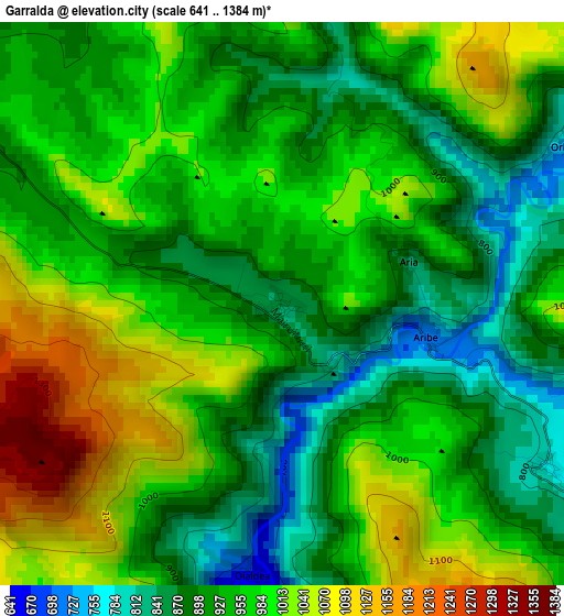
Below is the Elevation map of Garralda, which displays elevation range with different colors. Scale of the first map is from 641 to 1384 m (2103 to 4541 ft) with average elevation of 954 meters (=3130 ft) [note 1]
These maps also provides idea of topography and contour of this city, they are displayed at different zoom levels. More info about maps, scale and edge coordinates you can find below images.
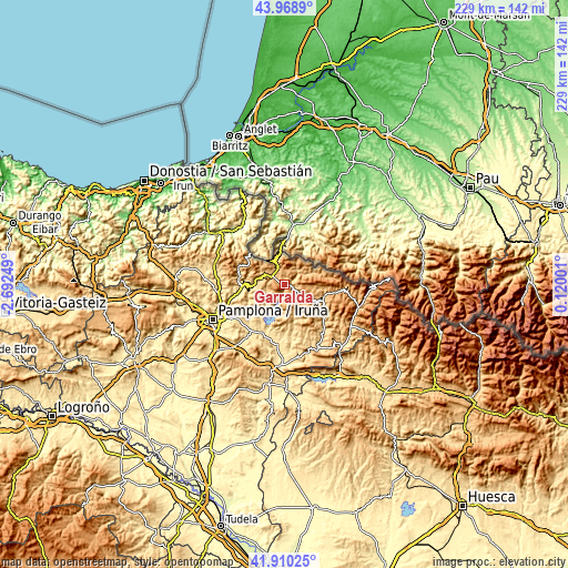
| \ | Map #1 | Topo.Map |
| Scale [m] | 641..1384 m | × |
| Scale [ft] | 2103..4541 ft | × |
| Average | 954 m = 3130 ft | × |
| Width | 7.15 km = 4.4 mi | 228.9 km = 142.2 mi |
| Height | 7.15 km = 4.4 mi | 228.9 km = 142.2 mi |
| ↑Max Latitude | 42.980338° | 43.9689° |
| Latitude at center | 42.94818° | 42.94818° |
| ↓Min Latitude | 42.916005° | 41.91025° |
| ← Min Longitude | -1.330185° | -2.69249° |
| Longitude center | -1.28624° | -1.28624° |
| →Max Longitude | -1.242295° | 0.12001° |
Nearby cities:
Cities around Garralda sort by population:
• Sarriguren elevation 460 m
29.5 km,  239°
239°
• Atarrabia 436 m
29.2 km, 243°
• Huarte-Uharte 441 m
28.1 km, 242°
• Aoiz 510 m
19.3 km,  201°
201°
• Lizoáin 537 m
22.2 km,  221°
221°
• Navascués 616 m
29.1 km,  151°
151°
• Aria 846 m
1.7 km,  72°
72°
• Orbara 774 m
4.2 km,  59°
59°
• Oronz 727 m
17.8 km,  119°
119°
• Lantz 646 m
27.5 km,  282°
282°
• Garaioa 896 m
4.6 km,  110°
110°
• Aribe 798 m
3 km,  86°
86°
Multilingual:
 En español:
Garralda elevación 850 m.
 En France:
Garralda élévation 850 m.
 Auf Deutsch:
Garralda höhe über dem Meeresspiegel ist 850 m.

Sources and notes:
- [note 1] Map square and city borders are not equal. Map elevation data is calculated only from area inside that square.
- [src 1] Elevation data from geonames database provided with same terms of usage.
- [src 2] The elevation map of Garralda is generated using elevation data from NASA's 3 arcsec (90m) resolution SRTM data.
- [src 3] Base (background) map © OpenStreetMap contributors tiles are generated by Geofabrik and OpenTopoMap.
Copyright & License:
This Garralda Elevation Map is licensed under CC BY-SA. You may reuse any part from this page, if you give a proper credit by linking to this URL:
 More info on terms of use page.