Gimialcón elevation
Gimialcón (Castille and León, Provincia de Ávila), Spain elevation is 943 meters and Gimialcón elevation in feet is 3094 ft above sea level [src 1]. Gimialcón is a seat of a third-order administrative division (feature code) with elevation that is 340 meters (1115 ft) bigger than average city elevation in Spain.
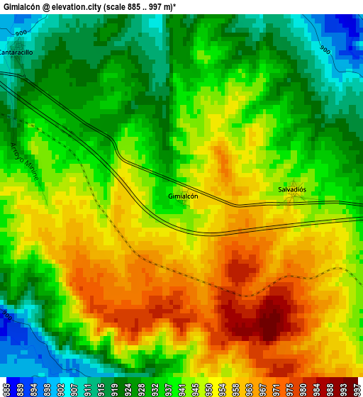
Below is the Elevation map of Gimialcón, which displays elevation range with different colors. Scale of the first map is from 885 to 997 m (2904 to 3271 ft) with average elevation of 941.3 meters (=3088 ft) [note 1]
These maps also provides idea of topography and contour of this city, they are displayed at different zoom levels. More info about maps, scale and edge coordinates you can find below images.
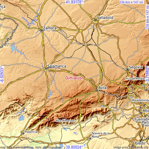
| \ | Map #1 | Topo.Map |
| Scale [m] | 885..997 m | × |
| Scale [ft] | 2904..3271 ft | × |
| Average | 941.3 m = 3088 ft | × |
| Width | 7.39 km = 4.6 mi | 236.4 km = 146.9 mi |
| Height | 7.39 km = 4.6 mi | 236.4 km = 146.9 mi |
| ↑Max Latitude | 40.910269° | 41.93178° |
| Latitude at center | 40.87705° | 40.87705° |
| ↓Min Latitude | 40.843814° | 39.80524° |
| ← Min Longitude | -5.167025° | -6.52933° |
| Longitude center | -5.12308° | -5.12308° |
| →Max Longitude | -5.079135° | -3.71683° |
Nearby cities:
Cities around Gimialcón sort by population:
• Peñaranda de Bracamonte elevation 908 m
7 km,  292°
292°
• Flores de Ávila 902 m
7.3 km,  30°
30°
• Aldeaseca de la Frontera 872 m
10.1 km,  315°
315°
• Mancera de Abajo 895 m
7.6 km,  237°
237°
• Bóveda del Río Almar 883 m
7.7 km,  253°
253°
• Blascomillán 949 m
8.9 km,  160°
160°
• Cantaracillo 912 m
4.5 km,  311°
311°
• Narros del Castillo 952 m
5.7 km,  111°
111°
• Herreros de Suso 1011 m
10.8 km,  139°
139°
• Muñosancho 906 m
8.8 km,  56°
56°
• Mancera de Arriba 935 m
9.7 km,  192°
192°
• Salvadiós 947 m
2.3 km,  86°
86°
Multilingual:
 En español:
Gimialcón elevación 943 m.
 En France:
Gimialcón élévation 943 m.
 Auf Deutsch:
Gimialcón höhe über dem Meeresspiegel ist 943 m.

Sources and notes:
- [note 1] Map square and city borders are not equal. Map elevation data is calculated only from area inside that square.
- [src 1] Elevation data from geonames database provided with same terms of usage.
- [src 2] The elevation map of Gimialcón is generated using elevation data from NASA's 3 arcsec (90m) resolution SRTM data.
- [src 3] Base (background) map © OpenStreetMap contributors tiles are generated by Geofabrik and OpenTopoMap.
Copyright & License:
This Gimialcón Elevation Map is licensed under CC BY-SA. You may reuse any part from this page, if you give a proper credit by linking to this URL:
 More info on terms of use page.