Gomecello elevation
Gomecello (Castille and León, Provincia de Salamanca), Spain elevation is 844 meters and Gomecello elevation in feet is 2769 ft above sea level [src 1]. Gomecello is a seat of a third-order administrative division (feature code) with elevation that is 241 meters (791 ft) bigger than average city elevation in Spain.
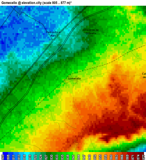
Below is the Elevation map of Gomecello, which displays elevation range with different colors. Scale of the first map is from 805 to 877 m (2641 to 2877 ft) with average elevation of 839.9 meters (=2756 ft) [note 1]
These maps also provides idea of topography and contour of this city, they are displayed at different zoom levels. More info about maps, scale and edge coordinates you can find below images.
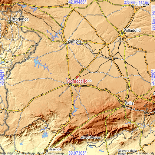
| \ | Map #1 | Topo.Map |
| Scale [m] | 805..877 m | × |
| Scale [ft] | 2641..2877 ft | × |
| Average | 839.9 m = 2756 ft | × |
| Width | 7.37 km = 4.6 mi | 235.9 km = 146.6 mi |
| Height | 7.37 km = 4.6 mi | 235.8 km = 146.5 mi |
| ↑Max Latitude | 41.075936° | 42.09486° |
| Latitude at center | 41.0428° | 41.0428° |
| ↓Min Latitude | 41.009647° | 39.97365° |
| ← Min Longitude | -5.579795° | -6.9421° |
| Longitude center | -5.53585° | -5.53585° |
| →Max Longitude | -5.491905° | -4.1296° |
Nearby cities:
Cities around Gomecello sort by population:
• San Cristóbal de la Cuesta elevation 818 m
7 km,  257°
257°
• Aldealengua 785 m
7 km,  189°
189°
• Aldearrubia 814 m
5 km,  140°
140°
• Castellanos de Moriscos 836 m
5.3 km,  240°
240°
• San Morales 795 m
6.2 km,  152°
152°
• Pitiegua 847 m
6.2 km,  69°
69°
• Villaverde de Guareña 831 m
2.5 km,  21°
21°
• Pajares de la Laguna 828 m
5.5 km, 24°
• Pedrosillo el Ralo 815 m
2.5 km,  335°
335°
• Cabezabellosa de la Calzada 855 m
4 km,  88°
88°
• Moriscos 844 m
5.4 km,  225°
225°
• Arcediano 826 m
6 km, 339°
Multilingual:
 En español:
Gomecello elevación 844 m.
 En France:
Gomecello élévation 844 m.
 Auf Deutsch:
Gomecello höhe über dem Meeresspiegel ist 844 m.

Sources and notes:
- [note 1] Map square and city borders are not equal. Map elevation data is calculated only from area inside that square.
- [src 1] Elevation data from geonames database provided with same terms of usage.
- [src 2] The elevation map of Gomecello is generated using elevation data from NASA's 3 arcsec (90m) resolution SRTM data.
- [src 3] Base (background) map © OpenStreetMap contributors tiles are generated by Geofabrik and OpenTopoMap.
Copyright & License:
This Gomecello Elevation Map is licensed under CC BY-SA. You may reuse any part from this page, if you give a proper credit by linking to this URL:
 More info on terms of use page.