O Grove elevation
O Grove (Galicia, Provincia de Pontevedra), Spain elevation is 13 meters and O Grove elevation in feet is 43 ft above sea level [src 1]. O Grove is a populated place (feature code) with elevation that is 590 meters (1936 ft) smaller than average city elevation in Spain.
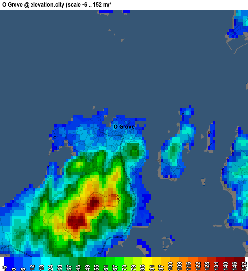
Below is the Elevation map of O Grove, which displays elevation range with different colors. Scale of the first map is from -6 to 152 m (-20 to 499 ft) with average elevation of 34.2 meters (=112 ft) [note 1]
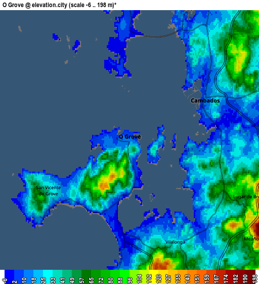
These maps also provides idea of topography and contour of this city, they are displayed at different zoom levels. More info about maps, scale and edge coordinates you can find below images.
| \ | Map #1 | Map #2 | Topo.Map |
| Scale [m] | -6..152 m | -6..198 m | × |
| Scale [ft] | -20..499 ft | -20..650 ft | × |
| Average | 34.2 m = 112 ft | 35.2 m = 115 ft | × |
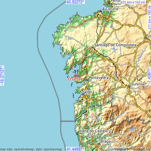
| Width | 7.21 km = 4.5 mi | 14.41 km = 9 mi | 230.6 km = 143.3 mi |
| Height | 7.21 km = 4.5 mi | 14.41 km = 9 mi | 230.6 km = 143.3 mi |
| ↑Max Latitude | 42.526834° | 42.559212° | 43.52272° |
| Latitude at center | 42.49444° | 42.49444° | 42.49444° |
| ↓Min Latitude | 42.462029° | 42.429601° | 41.44897° |
| ← Min Longitude | -8.908965° | -8.952911° | -10.27127° |
| Longitude center | -8.86502° | -8.86502° | -8.86502° |
| →Max Longitude | -8.821075° | -8.777129° | -7.45877° |
Nearby cities:
Cities around O Grove sort by population:
• Santa Uxía de Ribeira elevation 18 m
12.2 km,  302°
302°
• Sanxenxo 11 m
11.5 km,  155°
155°
• Cambados 14 m
4.7 km,  65°
65°
• Vilanova de Arousa 6 m
8.3 km,  21°
21°
• Meaño 119 m
8.7 km,  127°
127°
• Illa de Arousa 0 m
7.7 km,  355°
355°
• Meis 98 m
9.4 km,  86°
86°
• Ribadumia 45 m
9.7 km,  75°
75°
• Portonovo 27 m
11.6 km, 163°
• Palmeira 30 m
12.1 km,  324°
324°
• Sobradelo 34 m
11.9 km,  34°
34°
• Vilaxoán 11 m
11.5 km, 30°
Multilingual:
 En español:
El Grove elevación 13 m.
 En France:
O Grove élévation 13 m.


Sources and notes:
- [note 1] Map square and city borders are not equal. Map elevation data is calculated only from area inside that square.
- [src 1] Elevation data from geonames database provided with same terms of usage.
- [src 2] The elevation map of O Grove is generated using elevation data from NASA's 3 arcsec (90m) resolution SRTM data.
- [src 3] Base (background) map © OpenStreetMap contributors tiles are generated by Geofabrik and OpenTopoMap.
Copyright & License:
This O Grove Elevation Map is licensed under CC BY-SA. You may reuse any part from this page, if you give a proper credit by linking to this URL:
 More info on terms of use page.