L'Hospitalet de Llobregat elevation
L'Hospitalet de Llobregat (Catalonia, Província de Barcelona), Spain elevation is 18 meters and L'Hospitalet de Llobregat elevation in feet is 59 ft above sea level [src 1]. L'Hospitalet de Llobregat is a populated place (feature code) with elevation that is 585 meters (1919 ft) smaller than average city elevation in Spain.
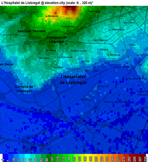
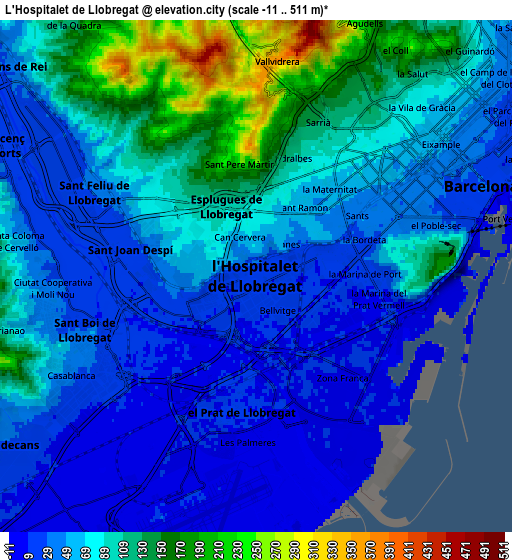
Below is the Elevation map of L'Hospitalet de Llobregat, which displays elevation range with different colors. Scale of the first map is from -6 to 320 m (-20 to 1050 ft) with average elevation of 41.4 meters (=136 ft) [note 1]
These maps also provides idea of topography and contour of this city, they are displayed at different zoom levels. More info about maps, scale and edge coordinates you can find below images.
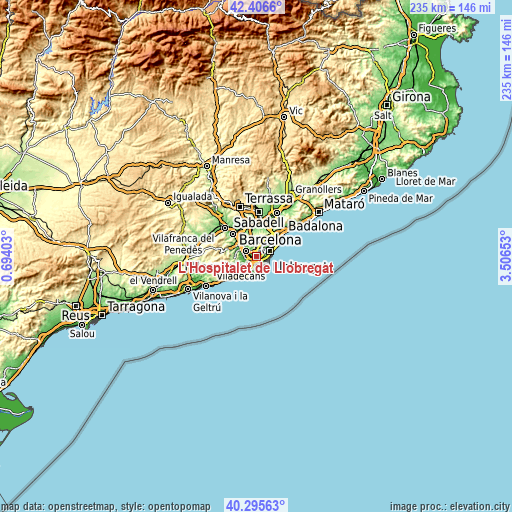
| \ | Map #1 | Map #2 | Topo.Map |
| Scale [m] | -6..320 m | -11..511 m | × |
| Scale [ft] | -20..1050 ft | -36..1677 ft | × |
| Average | 41.4 m = 136 ft | 71 m = 233 ft | × |
| Width | 7.33 km = 4.6 mi | 14.67 km = 9.1 mi | 234.7 km = 145.8 mi |
| Height | 7.34 km = 4.6 mi | 14.67 km = 9.1 mi | 234.7 km = 145.8 mi |
| ↑Max Latitude | 41.392646° | 41.425605° | 42.4066° |
| Latitude at center | 41.35967° | 41.35967° | 41.35967° |
| ↓Min Latitude | 41.326677° | 41.293668° | 40.29563° |
| ← Min Longitude | 2.056335° | 2.012389° | 0.69403° |
| Longitude center | 2.10028° | 2.10028° | 2.10028° |
| →Max Longitude | 2.144225° | 2.188171° | 3.50653° |
Nearby cities:
Cities around L'Hospitalet de Llobregat sort by population:
• Cornellà de Llobregat elevation 12 m
1.8 km,  232°
232°
• Les Corts 73 m
3.9 km,  39°
39°
• El Prat de Llobregat 9 m
3.6 km,  187°
187°
• Esplugues de Llobregat 102 m
2.2 km,  332°
332°
• Sants 45 m
3.6 km,  62°
62°
• Sant Joan Despí 22 m
3.7 km,  283°
283°
• la Marina de Port 20 m
3.3 km,  89°
89°
• Sants - Badal 41 m
2.8 km,  53°
53°
• la Maternitat i Sant Ramon 56 m
2.8 km,  30°
30°
• Sant Just Desvern 91 m
3.8 km,  314°
314°
• Pedralbes 130 m
3.5 km,  13°
13°
• la Font de la Guatlla 48 m
3.9 km,  73°
73°
Multilingual:
 En español:
Hospitalet de Llobregat elevación 18 m.
 En France:
L'Hospitalet de Llobregat élévation 18 m.
 Auf Deutsch:
L'Hospitalet de Llobregat höhe über dem Meeresspiegel ist 18 m.
 На русском:
Оспиталет-де-Льобрегат высота над уровнем моря 18 м
Sources and notes:
- [note 1] Map square and city borders are not equal. Map elevation data is calculated only from area inside that square.
- [src 1] Elevation data from geonames database provided with same terms of usage.
- [src 2] The elevation map of L'Hospitalet de Llobregat is generated using elevation data from NASA's 3 arcsec (90m) resolution SRTM data.
- [src 3] Base (background) map © OpenStreetMap contributors tiles are generated by Geofabrik and OpenTopoMap.
Copyright & License:
This L'Hospitalet de Llobregat Elevation Map is licensed under CC BY-SA. You may reuse any part from this page, if you give a proper credit by linking to this URL:
 More info on terms of use page.