La Sagrera elevation
La Sagrera (Catalonia, Província de Barcelona), Spain elevation is 41 meters and La Sagrera elevation in feet is 135 ft above sea level [src 1]. La Sagrera is a section of populated place (feature code) with elevation that is 562 meters (1844 ft) smaller than average city elevation in Spain.
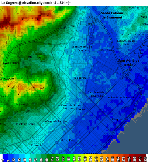
Below is the Elevation map of La Sagrera, which displays elevation range with different colors. Scale of the first map is from -4 to 331 m (-13 to 1086 ft) with average elevation of 71.4 meters (=234 ft) [note 1]
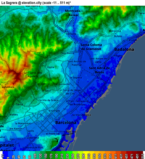
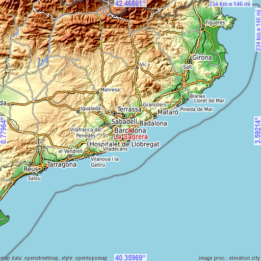
These maps also provides idea of topography and contour of this city, they are displayed at different zoom levels. More info about maps, scale and edge coordinates you can find below images.
| \ | Map #1 | Map #2 | Topo.Map |
| Scale [m] | -4..331 m | -11..511 m | × |
| Scale [ft] | -13..1086 ft | -36..1677 ft | × |
| Average | 71.4 m = 234 ft | 112.2 m = 368 ft | × |
| Width | 7.33 km = 4.6 mi | 14.66 km = 9.1 mi | 234.5 km = 145.7 mi |
| Height | 7.33 km = 4.6 mi | 14.66 km = 9.1 mi | 234.5 km = 145.7 mi |
| ↑Max Latitude | 41.455654° | 41.488581° | 42.46861° |
| Latitude at center | 41.42271° | 41.42271° | 41.42271° |
| ↓Min Latitude | 41.389749° | 41.356772° | 40.35969° |
| ← Min Longitude | 2.141945° | 2.097999° | 0.77964° |
| Longitude center | 2.18589° | 2.18589° | 2.18589° |
| →Max Longitude | 2.229835° | 2.273781° | 3.59214° |
Nearby cities:
Cities around La Sagrera sort by population:
• Sant Martí elevation 21 m
1.2 km,  114°
114°
• Sant Andreu 34 m
1.4 km,  13°
13°
• Barri de Sant Andreu 38 m
1.6 km, 12°
• el Camp de l'Arpa del Clot 44 m
1.2 km,  193°
193°
• el Guinardó 102 m
1.1 km,  247°
247°
• la Verneda i la Pau 26 m
1.4 km,  84°
84°
• el Clot 18 m
1.5 km,  164°
164°
• Sant Martí de Provençals 11 m
0.9 km, 107°
• Vilapicina i la Torre Llobeta 66 m
1.2 km,  303°
303°
• Porta 54 m
1.5 km,  336°
336°
• Navas 42 m
0.5 km,  179°
179°
• el Congrés i els Indians 51 m
0.5 km, 296°
Multilingual:
 En español:
Barrio La Sagrera elevación 41 m.
 En France:
La Sagrera élévation 41 m.
 Auf Deutsch:
La Sagrera höhe über dem Meeresspiegel ist 41 m.

Sources and notes:
- [note 1] Map square and city borders are not equal. Map elevation data is calculated only from area inside that square.
- [src 1] Elevation data from geonames database provided with same terms of usage.
- [src 2] The elevation map of La Sagrera is generated using elevation data from NASA's 3 arcsec (90m) resolution SRTM data.
- [src 3] Base (background) map © OpenStreetMap contributors tiles are generated by Geofabrik and OpenTopoMap.
Copyright & License:
This La Sagrera Elevation Map is licensed under CC BY-SA. You may reuse any part from this page, if you give a proper credit by linking to this URL:
 More info on terms of use page.