Leiva elevation
Leiva (La Rioja, Provincia de La Rioja), Spain elevation is 590 meters and Leiva elevation in feet is 1936 ft above sea level [src 1]. Leiva is a seat of a third-order administrative division (feature code) with elevation that is 13 meters (43 ft) smaller than average city elevation in Spain.
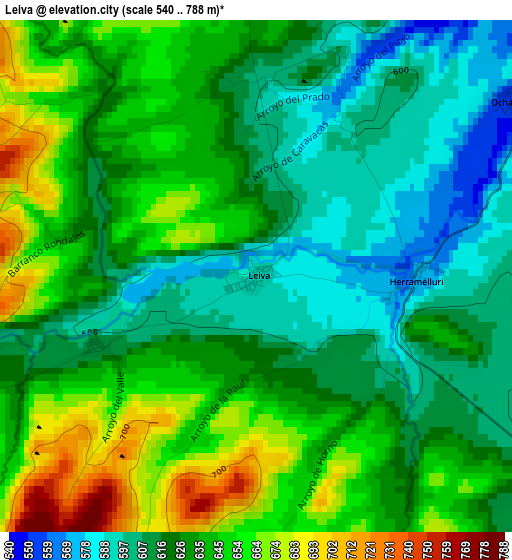
Below is the Elevation map of Leiva, which displays elevation range with different colors. Scale of the first map is from 540 to 788 m (1772 to 2585 ft) with average elevation of 630.2 meters (=2068 ft) [note 1]
These maps also provides idea of topography and contour of this city, they are displayed at different zoom levels. More info about maps, scale and edge coordinates you can find below images.
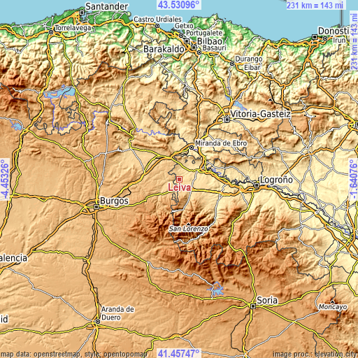
| \ | Map #1 | Topo.Map |
| Scale [m] | 540..788 m | × |
| Scale [ft] | 1772..2585 ft | × |
| Average | 630.2 m = 2068 ft | × |
| Width | 7.2 km = 4.5 mi | 230.6 km = 143.3 mi |
| Height | 7.2 km = 4.5 mi | 230.5 km = 143.2 mi |
| ↑Max Latitude | 42.5352° | 43.53096° |
| Latitude at center | 42.50281° | 42.50281° |
| ↓Min Latitude | 42.470403° | 41.45747° |
| ← Min Longitude | -3.090955° | -4.45326° |
| Longitude center | -3.04701° | -3.04701° |
| →Max Longitude | -3.003065° | -1.64076° |
Nearby cities:
Cities around Leiva sort by population:
• Grañón elevation 730 m
6.1 km,  164°
164°
• Treviana 581 m
6.3 km,  357°
357°
• Tormantos 612 m
2.4 km,  247°
247°
• Redecilla del Camino 743 m
7.4 km,  191°
191°
• Herramélluri 570 m
2.3 km,  89°
89°
• Villalobar de Rioja 581 m
6.9 km,  100°
100°
• Ibrillos 741 m
6.1 km,  208°
208°
• Redecilla del Campo 745 m
6.9 km,  234°
234°
• Ochánduri 551 m
4.3 km,  54°
54°
• San Millán de Yécora 658 m
6.4 km,  320°
320°
• Castildelgado 768 m
7.9 km,  202°
202°
• Cerezo de Río Tirón 661 m
7.4 km,  260°
260°
Multilingual:
 En español:
Leiva elevación 590 m.
 En France:
Leiva élévation 590 m.


Sources and notes:
- [note 1] Map square and city borders are not equal. Map elevation data is calculated only from area inside that square.
- [src 1] Elevation data from geonames database provided with same terms of usage.
- [src 2] The elevation map of Leiva is generated using elevation data from NASA's 3 arcsec (90m) resolution SRTM data.
- [src 3] Base (background) map © OpenStreetMap contributors tiles are generated by Geofabrik and OpenTopoMap.
Copyright & License:
This Leiva Elevation Map is licensed under CC BY-SA. You may reuse any part from this page, if you give a proper credit by linking to this URL:
 More info on terms of use page.