Llançà elevation
Llançà (Catalonia, Província de Girona), Spain elevation is 13 meters and Llançà elevation in feet is 43 ft above sea level [src 1]. Llançà is a populated place (feature code) with elevation that is 590 meters (1936 ft) smaller than average city elevation in Spain.
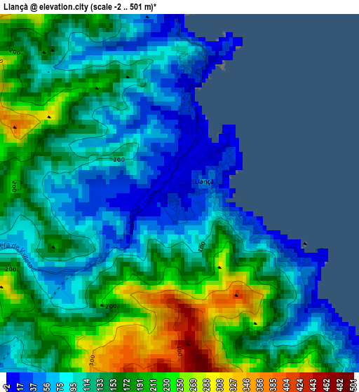
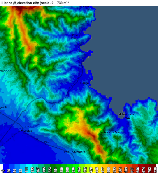
Below is the Elevation map of Llançà, which displays elevation range with different colors. Scale of the first map is from -2 to 501 m (-7 to 1644 ft) with average elevation of 141 meters (=463 ft) [note 1]
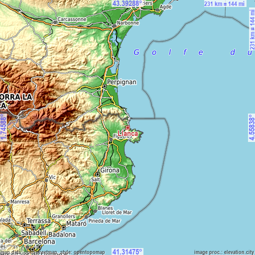
These maps also provides idea of topography and contour of this city, they are displayed at different zoom levels. More info about maps, scale and edge coordinates you can find below images.
| \ | Map #1 | Map #2 | Topo.Map |
| Scale [m] | -2..501 m | -2..730 m | × |
| Scale [ft] | -7..1644 ft | -7..2395 ft | × |
| Average | 141 m = 463 ft | 167.5 m = 550 ft | × |
| Width | 7.22 km = 4.5 mi | 14.44 km = 9 mi | 231.1 km = 143.6 mi |
| Height | 7.22 km = 4.5 mi | 14.44 km = 9 mi | 231.1 km = 143.6 mi |
| ↑Max Latitude | 42.394873° | 42.427319° | 43.39288° |
| Latitude at center | 42.36241° | 42.36241° | 42.36241° |
| ↓Min Latitude | 42.329931° | 42.297434° | 41.31475° |
| ← Min Longitude | 3.108185° | 3.064239° | 1.74588° |
| Longitude center | 3.15213° | 3.15213° | 3.15213° |
| →Max Longitude | 3.196075° | 3.240021° | 4.55838° |
Nearby cities:
Cities around Llançà sort by population:
• Roses elevation 11 m
11.3 km,  169°
169°
• Empuriabrava 2 m
13.1 km,  191°
191°
• Cadaqués 16 m
13.1 km,  128°
128°
• Portbou 18 m
7.1 km,  3°
3°
• Vilajuïga 32 m
6.4 km,  229°
229°
• Garriguella 63 m
7.4 km,  253°
253°
• Colera 16 m
4.6 km,  359°
359°
• Pau 38 m
5.9 km,  209°
209°
• Espolla 116 m
12.8 km,  284°
284°
• Rabós 110 m
10.3 km, 280°
• Mollet de Peralada 58 m
12.5 km,  268°
268°
• Vilamaniscle 156 m
7.1 km, 281°
Multilingual:
 En español:
Llançà elevación 13 m.
 En France:
Llançà élévation 13 m.


Sources and notes:
- [note 1] Map square and city borders are not equal. Map elevation data is calculated only from area inside that square.
- [src 1] Elevation data from geonames database provided with same terms of usage.
- [src 2] The elevation map of Llançà is generated using elevation data from NASA's 3 arcsec (90m) resolution SRTM data.
- [src 3] Base (background) map © OpenStreetMap contributors tiles are generated by Geofabrik and OpenTopoMap.
Copyright & License:
This Llançà Elevation Map is licensed under CC BY-SA. You may reuse any part from this page, if you give a proper credit by linking to this URL:
 More info on terms of use page.