Lomas elevation
Lomas (Castille and León, Provincia de Palencia), Spain elevation is 823 meters and Lomas elevation in feet is 2700 ft above sea level [src 1]. Lomas is a seat of a third-order administrative division (feature code) with elevation that is 220 meters (722 ft) bigger than average city elevation in Spain.
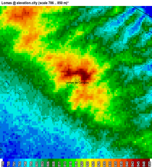
Below is the Elevation map of Lomas, which displays elevation range with different colors. Scale of the first map is from 786 to 850 m (2579 to 2789 ft) with average elevation of 808.9 meters (=2654 ft) [note 1]
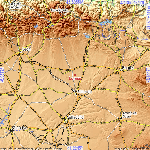
These maps also provides idea of topography and contour of this city, they are displayed at different zoom levels. More info about maps, scale and edge coordinates you can find below images.
| \ | Map #1 | Topo.Map |
| Scale [m] | 786..850 m | × |
| Scale [ft] | 2579..2789 ft | × |
| Average | 808.9 m = 2654 ft | × |
| Width | 7.23 km = 4.5 mi | 231.4 km = 143.8 mi |
| Height | 7.23 km = 4.5 mi | 231.4 km = 143.8 mi |
| ↑Max Latitude | 42.306129° | 43.30556° |
| Latitude at center | 42.27362° | 42.27362° |
| ↓Min Latitude | 42.241095° | 41.2245° |
| ← Min Longitude | -4.594895° | -5.9572° |
| Longitude center | -4.55095° | -4.55095° |
| →Max Longitude | -4.507005° | -3.1447° |
Nearby cities:
Cities around Lomas sort by population:
• Carrión de los Condes elevation 837 m
8.6 km,  331°
331°
• San Cebrián de Campos 790 m
8.3 km,  168°
168°
• Villoldo 769 m
4.7 km,  232°
232°
• Villalcázar de Sirga 807 m
4.8 km,  7°
7°
• Revenga de Campos 787 m
5.8 km,  78°
78°
• Población de Campos 782 m
8.5 km,  92°
92°
• Villovieco 787 m
6.2 km,  67°
67°
• San Mamés de Campos 821 m
9.1 km,  352°
352°
• Manquillos 776 m
7.7 km,  190°
190°
• Arconada 806 m
7.5 km,  36°
36°
• Amayuelas de Arriba 788 m
8.6 km,  143°
143°
• Villarmentero de Campos 790 m
5 km,  57°
57°
Multilingual:
 En español:
Lomas de Campos elevación 823 m.
 En France:
Lomas élévation 823 m.


Sources and notes:
- [note 1] Map square and city borders are not equal. Map elevation data is calculated only from area inside that square.
- [src 1] Elevation data from geonames database provided with same terms of usage.
- [src 2] The elevation map of Lomas is generated using elevation data from NASA's 3 arcsec (90m) resolution SRTM data.
- [src 3] Base (background) map © OpenStreetMap contributors tiles are generated by Geofabrik and OpenTopoMap.
Copyright & License:
This Lomas Elevation Map is licensed under CC BY-SA. You may reuse any part from this page, if you give a proper credit by linking to this URL:
 More info on terms of use page.