Matadepera elevation
Matadepera (Catalonia, Província de Barcelona), Spain elevation is 432 meters and Matadepera elevation in feet is 1417 ft above sea level [src 1]. Matadepera is a populated place (feature code) with elevation that is 171 meters (561 ft) smaller than average city elevation in Spain.
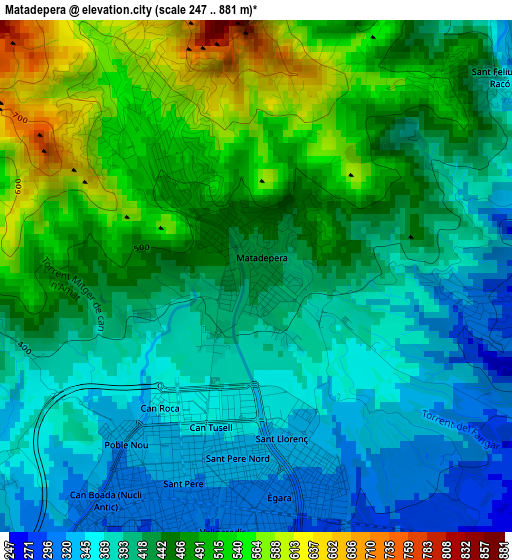
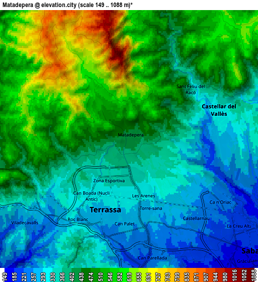
Below is the Elevation map of Matadepera, which displays elevation range with different colors. Scale of the first map is from 247 to 881 m (810 to 2890 ft) with average elevation of 436.3 meters (=1431 ft) [note 1]
These maps also provides idea of topography and contour of this city, they are displayed at different zoom levels. More info about maps, scale and edge coordinates you can find below images.
| \ | Map #1 | Map #2 | Topo.Map |
| Scale [m] | 247..881 m | 149..1088 m | × |
| Scale [ft] | 810..2890 ft | 489..3570 ft | × |
| Average | 436.3 m = 1431 ft | 428.3 m = 1405 ft | × |
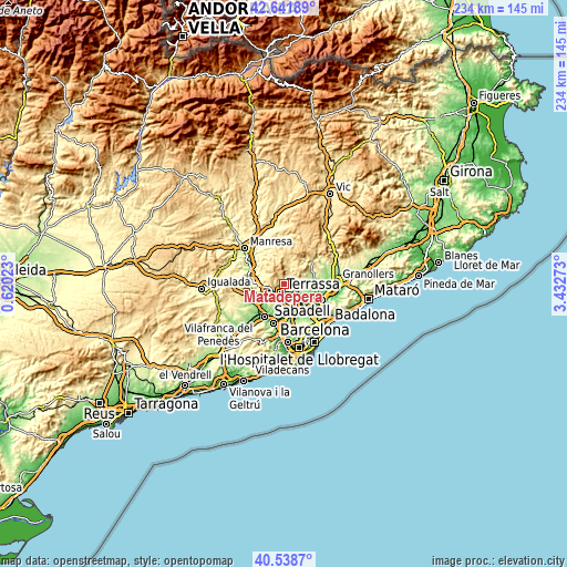
| Width | 7.31 km = 4.5 mi | 14.62 km = 9.1 mi | 233.9 km = 145.3 mi |
| Height | 7.31 km = 4.5 mi | 14.62 km = 9.1 mi | 233.8 km = 145.3 mi |
| ↑Max Latitude | 41.631714° | 41.664552° | 42.64189° |
| Latitude at center | 41.59886° | 41.59886° | 41.59886° |
| ↓Min Latitude | 41.565989° | 41.533101° | 40.5387° |
| ← Min Longitude | 1.982535° | 1.938589° | 0.62023° |
| Longitude center | 2.02648° | 2.02648° | 2.02648° |
| →Max Longitude | 2.070425° | 2.114371° | 3.43273° |
Nearby cities:
Cities around Matadepera sort by population:
• Terrassa elevation 302 m
3.7 km,  192°
192°
• Sabadell 187 m
9.3 km,  131°
131°
• Rubí 145 m
11.9 km,  177°
177°
• Barberà del Vallès 144 m
12.3 km,  138°
138°
• Castellar del Vallès 299 m
5.1 km,  67°
67°
• Sant Quirze del Vallès 178 m
8.7 km,  147°
147°
• Caldes de Montbui 232 m
12.3 km, 71°
• Sentmenat 213 m
9.1 km,  83°
83°
• Polinyà 162 m
11.6 km,  117°
117°
• Ullastrell 317 m
10 km,  216°
216°
• Mura 461 m
11.9 km,  339°
339°
• Viladecavalls 298 m
8.4 km,  229°
229°
Multilingual:
 En español:
Matadepera elevación 432 m.
 En France:
Matadepera élévation 432 m.
 Auf Deutsch:
Matadepera höhe über dem Meeresspiegel ist 432 m.

Sources and notes:
- [note 1] Map square and city borders are not equal. Map elevation data is calculated only from area inside that square.
- [src 1] Elevation data from geonames database provided with same terms of usage.
- [src 2] The elevation map of Matadepera is generated using elevation data from NASA's 3 arcsec (90m) resolution SRTM data.
- [src 3] Base (background) map © OpenStreetMap contributors tiles are generated by Geofabrik and OpenTopoMap.
Copyright & License:
This Matadepera Elevation Map is licensed under CC BY-SA. You may reuse any part from this page, if you give a proper credit by linking to this URL:
 More info on terms of use page.