Nigrán elevation
Nigrán (Galicia, Provincia de Pontevedra), Spain elevation is 39 meters and Nigrán elevation in feet is 128 ft above sea level [src 1]. Nigrán is a seat of a third-order administrative division (feature code) with elevation that is 564 meters (1850 ft) smaller than average city elevation in Spain.
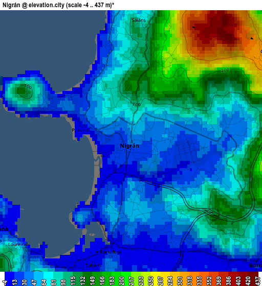
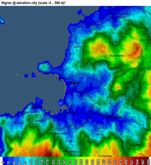
Below is the Elevation map of Nigrán, which displays elevation range with different colors. Scale of the first map is from -4 to 437 m (-13 to 1434 ft) with average elevation of 90.3 meters (=296 ft) [note 1]
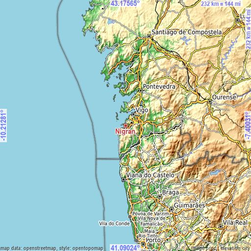
These maps also provides idea of topography and contour of this city, they are displayed at different zoom levels. More info about maps, scale and edge coordinates you can find below images.
| \ | Map #1 | Map #2 | Topo.Map |
| Scale [m] | -4..437 m | -4..590 m | × |
| Scale [ft] | -13..1434 ft | -13..1936 ft | × |
| Average | 90.3 m = 296 ft | 155.6 m = 510 ft | × |
| Width | 7.25 km = 4.5 mi | 14.49 km = 9 mi | 231.9 km = 144.1 mi |
| Height | 7.25 km = 4.5 mi | 14.49 km = 9 mi | 231.9 km = 144.1 mi |
| ↑Max Latitude | 42.174107° | 42.206666° | 43.17565° |
| Latitude at center | 42.14153° | 42.14153° | 42.14153° |
| ↓Min Latitude | 42.108937° | 42.076326° | 41.09024° |
| ← Min Longitude | -8.850505° | -8.894451° | -10.21281° |
| Longitude center | -8.80656° | -8.80656° | -8.80656° |
| →Max Longitude | -8.762615° | -8.718669° | -7.40031° |
Nearby cities:
Cities around Nigrán sort by population:
• Vigo elevation 86 m
12.3 km,  34°
34°
• Redondela 6 m
22.6 km,  45°
45°
• Cangas do Morrazo 14 m
13.8 km,  7°
7°
• Moaña 1 m
16.2 km,  20°
20°
• Porriño 39 m
15.6 km,  81°
81°
• Tui 50 m
17 km,  128°
128°
• Gondomar 52 m
5.8 km, 125°
• Tomiño 17 m
17.6 km,  166°
166°
• Bueu 11 m
20.4 km,  4°
4°
• Baiona 45 m
4.5 km,  232°
232°
• O Rosal 25 m
23.1 km,  186°
186°
• Oia 205 m
16.5 km,  197°
197°
Multilingual:
 En español:
Nigrán elevación 39 m.
 En France:
Nigrán élévation 39 m.


Sources and notes:
- [note 1] Map square and city borders are not equal. Map elevation data is calculated only from area inside that square.
- [src 1] Elevation data from geonames database provided with same terms of usage.
- [src 2] The elevation map of Nigrán is generated using elevation data from NASA's 3 arcsec (90m) resolution SRTM data.
- [src 3] Base (background) map © OpenStreetMap contributors tiles are generated by Geofabrik and OpenTopoMap.
Copyright & License:
This Nigrán Elevation Map is licensed under CC BY-SA. You may reuse any part from this page, if you give a proper credit by linking to this URL:
 More info on terms of use page.