Obanos elevation
Obanos (Navarre, Provincia de Navarra), Spain elevation is 416 meters and Obanos elevation in feet is 1365 ft above sea level [src 1]. Obanos is a seat of a third-order administrative division (feature code) with elevation that is 187 meters (614 ft) smaller than average city elevation in Spain.
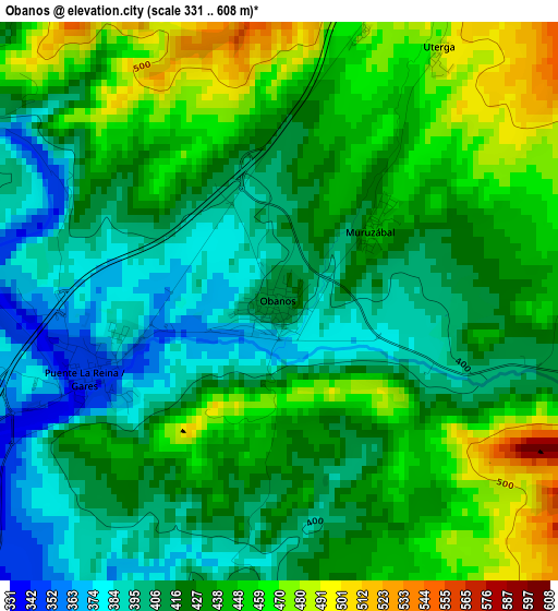
Below is the Elevation map of Obanos, which displays elevation range with different colors. Scale of the first map is from 331 to 608 m (1086 to 1995 ft) with average elevation of 427.8 meters (=1404 ft) [note 1]
These maps also provides idea of topography and contour of this city, they are displayed at different zoom levels. More info about maps, scale and edge coordinates you can find below images.
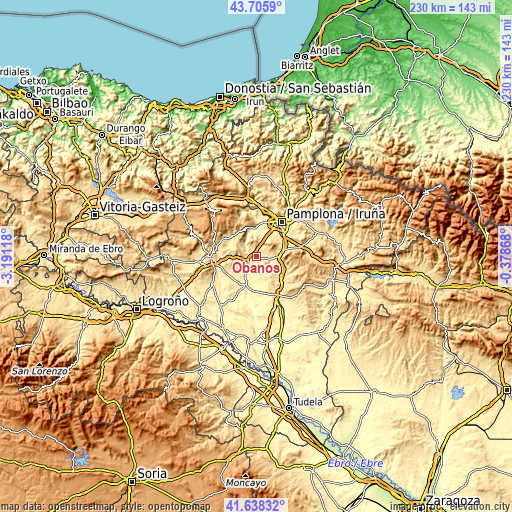
| \ | Map #1 | Topo.Map |
| Scale [m] | 331..608 m | × |
| Scale [ft] | 1086..1995 ft | × |
| Average | 427.8 m = 1404 ft | × |
| Width | 7.18 km = 4.5 mi | 229.9 km = 142.9 mi |
| Height | 7.18 km = 4.5 mi | 229.9 km = 142.9 mi |
| ↑Max Latitude | 42.713008° | 43.7059° |
| Latitude at center | 42.68071° | 42.68071° |
| ↓Min Latitude | 42.648396° | 41.63832° |
| ← Min Longitude | -1.828875° | -3.19118° |
| Longitude center | -1.78493° | -1.78493° |
| →Max Longitude | -1.740985° | -0.37868° |
Nearby cities:
Cities around Obanos sort by population:
• Puente la Reina elevation 352 m
2.5 km,  250°
250°
• Mendigorría 395 m
7.1 km,  214°
214°
• Mañeru 460 m
6.5 km,  259°
259°
• Muruzábal 447 m
1.7 km,  49°
49°
• Enériz 427 m
4.8 km,  103°
103°
• Uterga 494 m
3.8 km,  32°
32°
• Adiós 480 m
4.1 km,  81°
81°
• Legarda 477 m
3.7 km,  21°
21°
• Artazu 445 m
4.6 km,  286°
286°
• Guirguillano 616 m
8.6 km,  298°
298°
• Tirapu 503 m
7.2 km,  111°
111°
• Añorbe 577 m
6.3 km, 114°
Multilingual:
 En español:
Obanos elevación 416 m.
 En France:
Obanos élévation 416 m.


Sources and notes:
- [note 1] Map square and city borders are not equal. Map elevation data is calculated only from area inside that square.
- [src 1] Elevation data from geonames database provided with same terms of usage.
- [src 2] The elevation map of Obanos is generated using elevation data from NASA's 3 arcsec (90m) resolution SRTM data.
- [src 3] Base (background) map © OpenStreetMap contributors tiles are generated by Geofabrik and OpenTopoMap.
Copyright & License:
This Obanos Elevation Map is licensed under CC BY-SA. You may reuse any part from this page, if you give a proper credit by linking to this URL:
 More info on terms of use page.