Pradillo elevation
Pradillo (La Rioja, Provincia de La Rioja), Spain elevation is 890 meters and Pradillo elevation in feet is 2920 ft above sea level [src 1]. Pradillo is a seat of a third-order administrative division (feature code) with elevation that is 287 meters (942 ft) bigger than average city elevation in Spain.
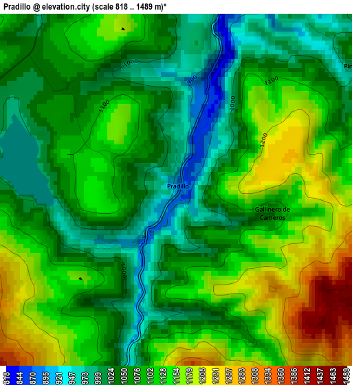
Below is the Elevation map of Pradillo, which displays elevation range with different colors. Scale of the first map is from 818 to 1489 m (2684 to 4885 ft) with average elevation of 1089.9 meters (=3576 ft) [note 1]
These maps also provides idea of topography and contour of this city, they are displayed at different zoom levels. More info about maps, scale and edge coordinates you can find below images.
| \ | Map #1 | Topo.Map |
| Scale [m] | 818..1489 m | × |
| Scale [ft] | 2684..4885 ft | × |
| Average | 1089.9 m = 3576 ft | × |
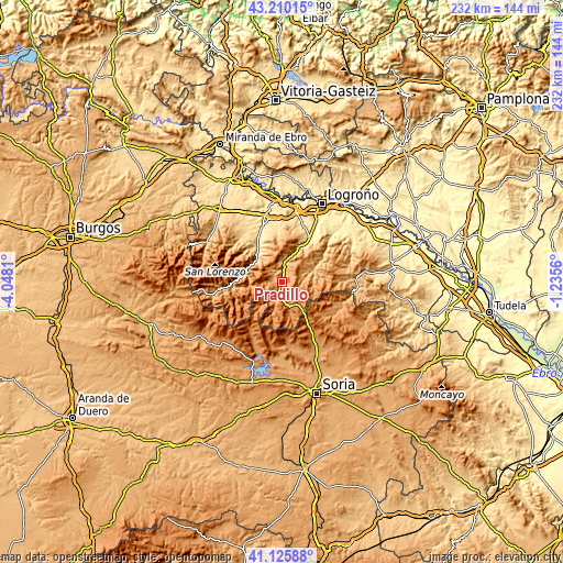
| Width | 7.24 km = 4.5 mi | 231.7 km = 144 mi |
| Height | 7.24 km = 4.5 mi | 231.7 km = 144 mi |
| ↑Max Latitude | 42.209159° | 43.21015° |
| Latitude at center | 42.1766° | 42.1766° |
| ↓Min Latitude | 42.144025° | 41.12588° |
| ← Min Longitude | -2.685795° | -4.0481° |
| Longitude center | -2.64185° | -2.64185° |
| →Max Longitude | -2.597905° | -1.2356° |
Nearby cities:
Cities around Pradillo sort by population:
• Torrecilla en Cameros elevation 747 m
8.8 km,  5°
5°
• Villoslada de Cameros 1077 m
7.5 km,  200°
200°
• Laguna de Cameros 1036 m
8.2 km,  91°
91°
• Nieva de Cameros 1006 m
5.1 km,  335°
335°
• Lumbreras 1199 m
8.2 km,  168°
168°
• Villanueva de Cameros 894 m
1.3 km,  213°
213°
• Cabezón de Cameros 940 m
10.3 km,  77°
77°
• Almarza de Cameros 1072 m
5.7 km,  38°
38°
• Gallinero de Cameros 1062 m
2 km,  103°
103°
• Pinillos 999 m
4.5 km,  55°
55°
• Nestares 866 m
10.6 km, 9°
• Ortigosa 1055 m
5.2 km,  268°
268°
Multilingual:
 En español:
Pradillo elevación 890 m.
 En France:
Pradillo élévation 890 m.
 Auf Deutsch:
Pradillo höhe über dem Meeresspiegel ist 890 m.

Sources and notes:
- [note 1] Map square and city borders are not equal. Map elevation data is calculated only from area inside that square.
- [src 1] Elevation data from geonames database provided with same terms of usage.
- [src 2] The elevation map of Pradillo is generated using elevation data from NASA's 3 arcsec (90m) resolution SRTM data.
- [src 3] Base (background) map © OpenStreetMap contributors tiles are generated by Geofabrik and OpenTopoMap.
Copyright & License:
This Pradillo Elevation Map is licensed under CC BY-SA. You may reuse any part from this page, if you give a proper credit by linking to this URL:
 More info on terms of use page.