Prado elevation
Prado (Castille and León, Provincia de Zamora), Spain elevation is 714 meters and Prado elevation in feet is 2343 ft above sea level [src 1]. Prado is a seat of a third-order administrative division (feature code) with elevation that is 111 meters (364 ft) bigger than average city elevation in Spain.
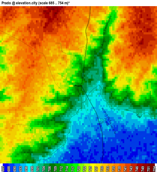
Below is the Elevation map of Prado, which displays elevation range with different colors. Scale of the first map is from 685 to 754 m (2247 to 2474 ft) with average elevation of 719.2 meters (=2360 ft) [note 1]
These maps also provides idea of topography and contour of this city, they are displayed at different zoom levels. More info about maps, scale and edge coordinates you can find below images.
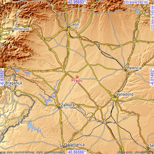
| \ | Map #1 | Topo.Map |
| Scale [m] | 685..754 m | × |
| Scale [ft] | 2247..2474 ft | × |
| Average | 719.2 m = 2360 ft | × |
| Width | 7.27 km = 4.5 mi | 232.7 km = 144.6 mi |
| Height | 7.27 km = 4.5 mi | 232.7 km = 144.6 mi |
| ↑Max Latitude | 41.95346° | 42.95853° |
| Latitude at center | 41.92077° | 41.92077° |
| ↓Min Latitude | 41.888063° | 40.86586° |
| ← Min Longitude | -5.464215° | -6.82652° |
| Longitude center | -5.42027° | -5.42027° |
| →Max Longitude | -5.376325° | -4.01402° |
Nearby cities:
Cities around Prado sort by population:
• Villalpando elevation 693 m
6.2 km,  173°
173°
• Villanueva del Campo 754 m
7.2 km,  9°
9°
• Villamayor de Campos 696 m
5.6 km,  116°
116°
• Castroverde de Campos 708 m
10.4 km,  57°
57°
• Cerecinos de Campos 697 m
5.9 km,  247°
247°
• Villalobos 726 m
5.3 km,  301°
301°
• Tapioles 688 m
9.4 km,  221°
221°
• Vega de Villalobos 735 m
6.6 km,  327°
327°
• Quintanilla del Monte 696 m
8.3 km,  134°
134°
• Villar de Fallaves 697 m
6.6 km,  85°
85°
• Quintanilla del Molar 747 m
8 km,  342°
342°
• Quintanilla del Olmo 696 m
2 km,  147°
147°
Multilingual:
 En español:
Prado elevación 714 m.
 En France:
Prado élévation 714 m.


Sources and notes:
- [note 1] Map square and city borders are not equal. Map elevation data is calculated only from area inside that square.
- [src 1] Elevation data from geonames database provided with same terms of usage.
- [src 2] The elevation map of Prado is generated using elevation data from NASA's 3 arcsec (90m) resolution SRTM data.
- [src 3] Base (background) map © OpenStreetMap contributors tiles are generated by Geofabrik and OpenTopoMap.
Copyright & License:
This Prado Elevation Map is licensed under CC BY-SA. You may reuse any part from this page, if you give a proper credit by linking to this URL:
 More info on terms of use page.