Ripollet elevation
Ripollet (Catalonia, Província de Barcelona), Spain elevation is 79 meters and Ripollet elevation in feet is 259 ft above sea level [src 1]. Ripollet is a seat of a third-order administrative division (feature code) with elevation that is 524 meters (1719 ft) smaller than average city elevation in Spain.
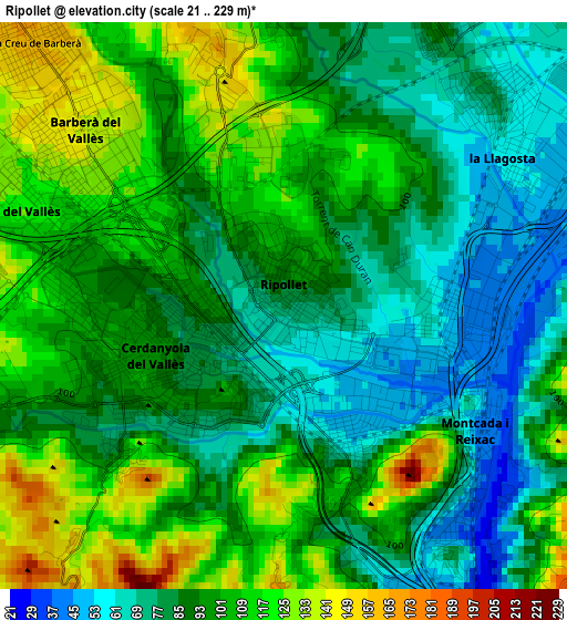
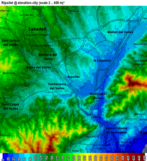
Below is the Elevation map of Ripollet, which displays elevation range with different colors. Scale of the first map is from 21 to 229 m (69 to 751 ft) with average elevation of 94.3 meters (=309 ft) [note 1]
These maps also provides idea of topography and contour of this city, they are displayed at different zoom levels. More info about maps, scale and edge coordinates you can find below images.
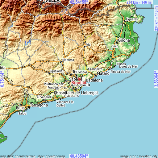
| \ | Map #1 | Map #2 | Topo.Map |
| Scale [m] | 21..229 m | 2..458 m | × |
| Scale [ft] | 69..751 ft | 7..1503 ft | × |
| Average | 94.3 m = 309 ft | 134.4 m = 441 ft | × |
| Width | 7.32 km = 4.5 mi | 14.64 km = 9.1 mi | 234.2 km = 145.5 mi |
| Height | 7.32 km = 4.5 mi | 14.64 km = 9.1 mi | 234.2 km = 145.5 mi |
| ↑Max Latitude | 41.529766° | 41.562656° | 42.54155° |
| Latitude at center | 41.49686° | 41.49686° | 41.49686° |
| ↓Min Latitude | 41.463937° | 41.430997° | 40.43504° |
| ← Min Longitude | 2.113445° | 2.069499° | 0.75114° |
| Longitude center | 2.15739° | 2.15739° | 2.15739° |
| →Max Longitude | 2.201335° | 2.245281° | 3.56364° |
Nearby cities:
Cities around Ripollet sort by population:
• Cerdanyola del Vallès elevation 88 m
1.5 km,  245°
245°
• Montcada i Reixac 66 m
2.6 km,  124°
124°
• Barberà del Vallès 144 m
3.5 km,  307°
307°
• Santa Perpètua de Mogoda 70 m
4.6 km,  28°
28°
• les Roquetes 146 m
5.6 km,  164°
164°
• La Llagosta 55 m
3.5 km,  56°
56°
• Ciutat Meridiana 98 m
4.2 km, 159°
• la Trinitat Vella 41 m
5.8 km,  149°
149°
• la Trinitat Nova 75 m
5.6 km, 156°
• Canyelles 168 m
5.8 km,  174°
174°
• Torre Baró 163 m
4.9 km, 163°
• Vallbona 33 m
4.3 km, 149°
Multilingual:
 En español:
Ripollet elevación 79 m.
 En France:
Ripollet élévation 79 m.


Sources and notes:
- [note 1] Map square and city borders are not equal. Map elevation data is calculated only from area inside that square.
- [src 1] Elevation data from geonames database provided with same terms of usage.
- [src 2] The elevation map of Ripollet is generated using elevation data from NASA's 3 arcsec (90m) resolution SRTM data.
- [src 3] Base (background) map © OpenStreetMap contributors tiles are generated by Geofabrik and OpenTopoMap.
Copyright & License:
This Ripollet Elevation Map is licensed under CC BY-SA. You may reuse any part from this page, if you give a proper credit by linking to this URL:
 More info on terms of use page.