Sils elevation
Sils (Catalonia, Província de Girona), Spain elevation is 79 meters and Sils elevation in feet is 259 ft above sea level [src 1]. Sils is a seat of a third-order administrative division (feature code) with elevation that is 524 meters (1719 ft) smaller than average city elevation in Spain.
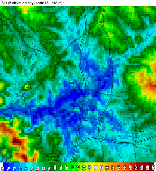
Below is the Elevation map of Sils, which displays elevation range with different colors. Scale of the first map is from 66 to 163 m (217 to 535 ft) with average elevation of 91.7 meters (=301 ft) [note 1]
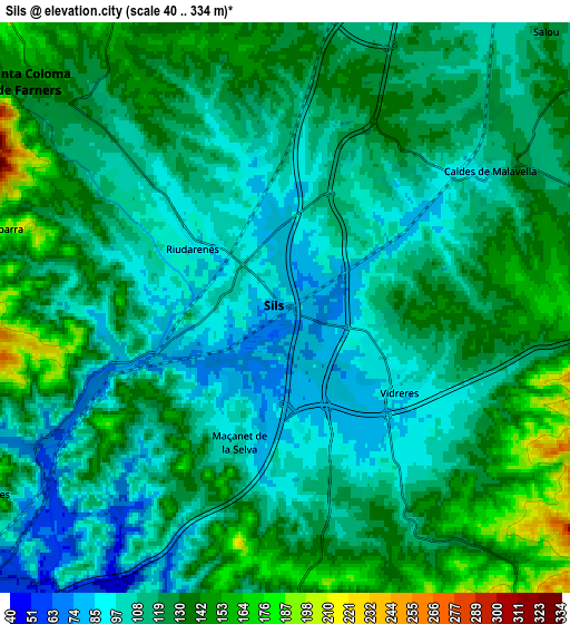
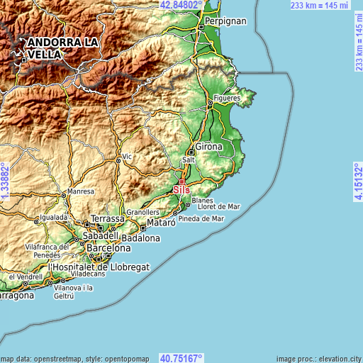
These maps also provides idea of topography and contour of this city, they are displayed at different zoom levels. More info about maps, scale and edge coordinates you can find below images.
| \ | Map #1 | Map #2 | Topo.Map |
| Scale [m] | 66..163 m | 40..334 m | × |
| Scale [ft] | 217..535 ft | 131..1096 ft | × |
| Average | 91.7 m = 301 ft | 119 m = 390 ft | × |
| Width | 7.28 km = 4.5 mi | 14.57 km = 9.1 mi | 233.1 km = 144.8 mi |
| Height | 7.28 km = 4.5 mi | 14.57 km = 9.1 mi | 233.1 km = 144.8 mi |
| ↑Max Latitude | 41.841167° | 41.873898° | 42.84802° |
| Latitude at center | 41.80842° | 41.80842° | 41.80842° |
| ↓Min Latitude | 41.775656° | 41.742875° | 40.75167° |
| ← Min Longitude | 2.701125° | 2.657179° | 1.33882° |
| Longitude center | 2.74507° | 2.74507° | 2.74507° |
| →Max Longitude | 2.789015° | 2.832961° | 4.15132° |
Nearby cities:
Cities around Sils sort by population:
• Tordera elevation 41 m
12.3 km,  190°
190°
• Santa Coloma de Farners 158 m
9.2 km,  314°
314°
• Hostalric 67 m
11.3 km,  234°
234°
• Riudellots de la Selva 100 m
10.6 km,  27°
27°
• Brunyola 265 m
11.4 km,  333°
333°
• Sant Andreu Salou 112 m
9.8 km,  48°
48°
• Massanes 151 m
9 km,  237°
237°
• Vilobí d'Onyar 114 m
8.3 km,  2°
2°
• Caldes de Malavella 110 m
6.5 km,  64°
64°
• Vidreres 83 m
4.2 km,  131°
131°
• Maçanet de la Selva 102 m
3 km,  199°
199°
• Riudarenes 90 m
2.5 km,  291°
291°
Multilingual:
 En español:
Sils elevación 79 m.
 En France:
Sils élévation 79 m.


Sources and notes:
- [note 1] Map square and city borders are not equal. Map elevation data is calculated only from area inside that square.
- [src 1] Elevation data from geonames database provided with same terms of usage.
- [src 2] The elevation map of Sils is generated using elevation data from NASA's 3 arcsec (90m) resolution SRTM data.
- [src 3] Base (background) map © OpenStreetMap contributors tiles are generated by Geofabrik and OpenTopoMap.
Copyright & License:
This Sils Elevation Map is licensed under CC BY-SA. You may reuse any part from this page, if you give a proper credit by linking to this URL:
 More info on terms of use page.