Susqueda elevation
Susqueda (Catalonia, Província de Girona), Spain elevation is 324 meters and Susqueda elevation in feet is 1063 ft above sea level [src 1]. Susqueda is a seat of a third-order administrative division (feature code) with elevation that is 279 meters (915 ft) smaller than average city elevation in Spain.
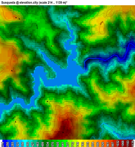
Below is the Elevation map of Susqueda, which displays elevation range with different colors. Scale of the first map is from 214 to 1139 m (702 to 3737 ft) with average elevation of 577.4 meters (=1894 ft) [note 1]
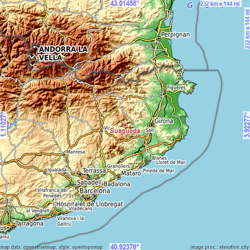
These maps also provides idea of topography and contour of this city, they are displayed at different zoom levels. More info about maps, scale and edge coordinates you can find below images.
| \ | Map #1 | Topo.Map |
| Scale [m] | 214..1139 m | × |
| Scale [ft] | 702..3737 ft | × |
| Average | 577.4 m = 1894 ft | × |
| Width | 7.26 km = 4.5 mi | 232.5 km = 144.5 mi |
| Height | 7.27 km = 4.5 mi | 232.5 km = 144.5 mi |
| ↑Max Latitude | 42.010421° | 43.01458° |
| Latitude at center | 41.97776° | 41.97776° |
| ↓Min Latitude | 41.945082° | 40.92378° |
| ← Min Longitude | 2.472575° | 1.11027° |
| Longitude center | 2.51652° | 2.51652° |
| →Max Longitude | 2.560465° | 3.92277° |
Nearby cities:
Cities around Susqueda sort by population:
• Anglès elevation 163 m
10.2 km,  103°
103°
• Santa Maria de Corcó 676 m
13.8 km,  296°
296°
• les Planes d'Hostoles 356 m
9 km,  12°
12°
• Sant Esteve d'en Bas 485 m
16.4 km,  342°
342°
• Vilanova de Sau 566 m
11.4 km,  252°
252°
• Tavertet 865 m
8.3 km,  283°
283°
• Sant Julià de Vilatorta 600 m
17.1 km, 248°
• Brunyola 265 m
16.3 km,  122°
122°
• Sant Aniol de Finestres 411 m
13.8 km,  24°
24°
• Sant Feliu de Pallerols 467 m
11.1 km,  356°
356°
• Sant Hilari Sacalm 857 m
10.5 km,  179°
179°
• la Cellera de Ter 157 m
8.9 km, 96°
Multilingual:
 En español:
Susqueda elevación 324 m.
 En France:
Susqueda élévation 324 m.
 Auf Deutsch:
Susqueda höhe über dem Meeresspiegel ist 324 m.

Sources and notes:
- [note 1] Map square and city borders are not equal. Map elevation data is calculated only from area inside that square.
- [src 1] Elevation data from geonames database provided with same terms of usage.
- [src 2] The elevation map of Susqueda is generated using elevation data from NASA's 3 arcsec (90m) resolution SRTM data.
- [src 3] Base (background) map © OpenStreetMap contributors tiles are generated by Geofabrik and OpenTopoMap.
Copyright & License:
This Susqueda Elevation Map is licensed under CC BY-SA. You may reuse any part from this page, if you give a proper credit by linking to this URL:
 More info on terms of use page.