Valls elevation
Valls (Catalonia, Província de Tarragona), Spain elevation is 223 meters and Valls elevation in feet is 732 ft above sea level [src 1]. Valls is a seat of a third-order administrative division (feature code) with elevation that is 380 meters (1247 ft) smaller than average city elevation in Spain.
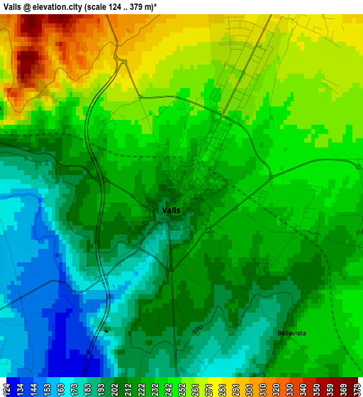
Below is the Elevation map of Valls, which displays elevation range with different colors. Scale of the first map is from 124 to 379 m (407 to 1243 ft) with average elevation of 226.3 meters (=742 ft) [note 1]
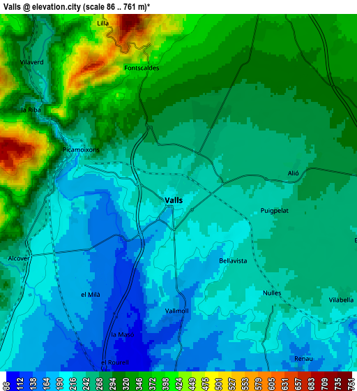
These maps also provides idea of topography and contour of this city, they are displayed at different zoom levels. More info about maps, scale and edge coordinates you can find below images.
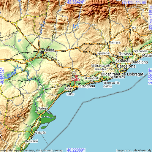
| \ | Map #1 | Map #2 | Topo.Map |
| Scale [m] | 124..379 m | 86..761 m | × |
| Scale [ft] | 407..1243 ft | 282..2497 ft | × |
| Average | 226.3 m = 742 ft | 263.1 m = 863 ft | × |
| Width | 7.34 km = 4.6 mi | 14.69 km = 9.1 mi | 235 km = 146 mi |
| Height | 7.34 km = 4.6 mi | 14.69 km = 9.1 mi | 235 km = 146 mi |
| ↑Max Latitude | 41.319133° | 41.35213° | 42.33424° |
| Latitude at center | 41.28612° | 41.28612° | 41.28612° |
| ↓Min Latitude | 41.25309° | 41.220043° | 40.22089° |
| ← Min Longitude | 1.205985° | 1.162039° | -0.15632° |
| Longitude center | 1.24993° | 1.24993° | 1.24993° |
| →Max Longitude | 1.293875° | 1.337821° | 2.65618° |
Nearby cities:
Cities around Valls sort by population:
• La Selva del Camp elevation 241 m
12.2 km,  229°
229°
• Alcover 246 m
7.2 km,  248°
248°
• El Pla de Santa Maria 381 m
9.3 km,  22°
22°
• Vallmoll 166 m
4.8 km,  180°
180°
• la Pobla de Mafumet 74 m
11.8 km,  193°
193°
• La Secuita 172 m
9.4 km,  164°
164°
• Vilabella 260 m
7.9 km,  122°
122°
• Puigpelat 258 m
4 km,  101°
101°
• Alió 264 m
4.8 km,  79°
79°
• Salomó 164 m
12.2 km, 121°
• Montferri 226 m
9.9 km, 103°
• Renau 169 m
8.5 km,  143°
143°
Multilingual:
 En español:
Valls elevación 223 m.
 En France:
Valls élévation 223 m.


Sources and notes:
- [note 1] Map square and city borders are not equal. Map elevation data is calculated only from area inside that square.
- [src 1] Elevation data from geonames database provided with same terms of usage.
- [src 2] The elevation map of Valls is generated using elevation data from NASA's 3 arcsec (90m) resolution SRTM data.
- [src 3] Base (background) map © OpenStreetMap contributors tiles are generated by Geofabrik and OpenTopoMap.
Copyright & License:
This Valls Elevation Map is licensed under CC BY-SA. You may reuse any part from this page, if you give a proper credit by linking to this URL:
 More info on terms of use page.