Villacarralón elevation
Villacarralón (Castille and León, Provincia de Valladolid), Spain elevation is 794 meters and Villacarralón elevation in feet is 2605 ft above sea level [src 1]. Villacarralón is a seat of a third-order administrative division (feature code) with elevation that is 191 meters (627 ft) bigger than average city elevation in Spain.
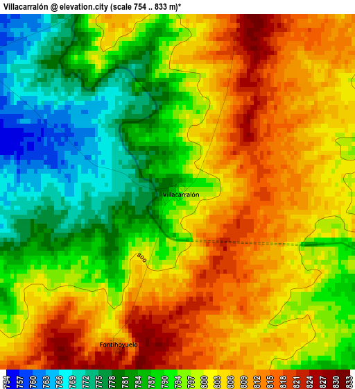
Below is the Elevation map of Villacarralón, which displays elevation range with different colors. Scale of the first map is from 754 to 833 m (2474 to 2733 ft) with average elevation of 797.2 meters (=2615 ft) [note 1]
These maps also provides idea of topography and contour of this city, they are displayed at different zoom levels. More info about maps, scale and edge coordinates you can find below images.
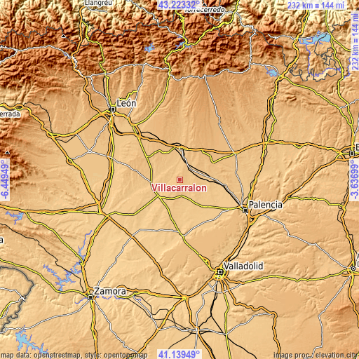
| \ | Map #1 | Topo.Map |
| Scale [m] | 754..833 m | × |
| Scale [ft] | 2474..2733 ft | × |
| Average | 797.2 m = 2615 ft | × |
| Width | 7.24 km = 4.5 mi | 231.7 km = 144 mi |
| Height | 7.24 km = 4.5 mi | 231.7 km = 144 mi |
| ↑Max Latitude | 42.222542° | 43.22332° |
| Latitude at center | 42.18999° | 42.18999° |
| ↓Min Latitude | 42.157422° | 41.13949° |
| ← Min Longitude | -5.087185° | -6.44949° |
| Longitude center | -5.04324° | -5.04324° |
| →Max Longitude | -4.999295° | -3.63699° |
Nearby cities:
Cities around Villacarralón sort by population:
• Villalón de Campos elevation 784 m
10 km,  175°
175°
• Villada 801 m
9.2 km,  42°
42°
• Melgar de Arriba 793 m
9.7 km,  332°
332°
• Melgar de Abajo 805 m
10.1 km,  306°
306°
• Santervás de Campos 762 m
5.6 km,  303°
303°
• Vega de Ruiponce 750 m
5.9 km,  267°
267°
• Bustillo de Chaves 817 m
7.7 km,  211°
211°
• Villagómez la Nueva 756 m
9 km,  245°
245°
• Villacidaler 799 m
6.5 km,  57°
57°
• Cabezón de Valderaduey 762 m
9.8 km,  255°
255°
• Villanueva de la Condesa 791 m
6.3 km,  223°
223°
• Fontihoyuelo 817 m
3.3 km,  201°
201°
Multilingual:
 En español:
Villacarralón elevación 794 m.
 En France:
Villacarralón élévation 794 m.
 Auf Deutsch:
Villacarralón höhe über dem Meeresspiegel ist 794 m.

Sources and notes:
- [note 1] Map square and city borders are not equal. Map elevation data is calculated only from area inside that square.
- [src 1] Elevation data from geonames database provided with same terms of usage.
- [src 2] The elevation map of Villacarralón is generated using elevation data from NASA's 3 arcsec (90m) resolution SRTM data.
- [src 3] Base (background) map © OpenStreetMap contributors tiles are generated by Geofabrik and OpenTopoMap.
Copyright & License:
This Villacarralón Elevation Map is licensed under CC BY-SA. You may reuse any part from this page, if you give a proper credit by linking to this URL:
 More info on terms of use page.