Antella elevation
Antella (Valencia, Província de València), Spain elevation is 51 meters and Antella elevation in feet is 167 ft above sea level [src 1]. Antella is a seat of a third-order administrative division (feature code) with elevation that is 552 meters (1811 ft) smaller than average city elevation in Spain.
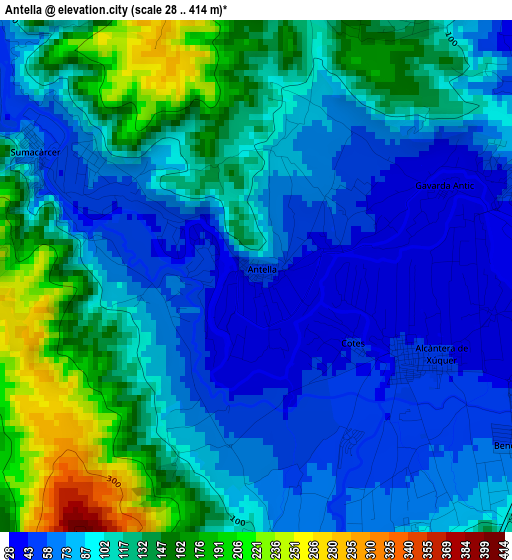
Below is the Elevation map of Antella, which displays elevation range with different colors. Scale of the first map is from 28 to 414 m (92 to 1358 ft) with average elevation of 103.6 meters (=340 ft) [note 1]
These maps also provides idea of topography and contour of this city, they are displayed at different zoom levels. More info about maps, scale and edge coordinates you can find below images.
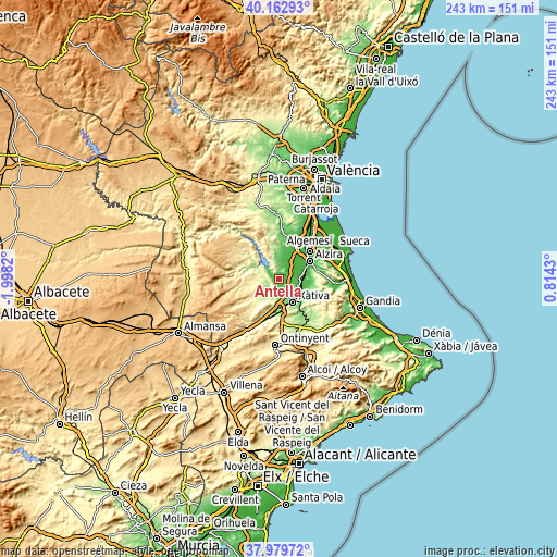
| \ | Map #1 | Topo.Map |
| Scale [m] | 28..414 m | × |
| Scale [ft] | 92..1358 ft | × |
| Average | 103.6 m = 340 ft | × |
| Width | 7.59 km = 4.7 mi | 242.8 km = 150.9 mi |
| Height | 7.59 km = 4.7 mi | 242.7 km = 150.8 mi |
| ↑Max Latitude | 39.113875° | 40.16293° |
| Latitude at center | 39.07977° | 39.07977° |
| ↓Min Latitude | 39.045648° | 37.97972° |
| ← Min Longitude | -0.635895° | -1.9982° |
| Longitude center | -0.59195° | -0.59195° |
| →Max Longitude | -0.548005° | 0.8143° |
Nearby cities:
Cities around Antella sort by population:
• Villanueva de Castellón elevation 41 m
6.9 km,  92°
92°
• Chella 229 m
7.2 km,  234°
234°
• Càrcer 45 m
2.6 km,  123°
123°
• Bolbaite 239 m
7.5 km,  253°
253°
• Alcàntera de Xúquer 39 m
3.9 km,  111°
111°
• Sumacàrcer 43 m
4.2 km,  302°
302°
• Gavarda 30 m
3.6 km,  83°
83°
• Tous 98 m
6.7 km,  3°
3°
• Beneixida 39 m
3.9 km, 111°
• Sellent 88 m
5.3 km,  176°
176°
• Cotes 45 m
1.9 km,  125°
125°
• Estubeny 158 m
7.4 km,  201°
201°
Multilingual:
 En español:
Antella elevación 51 m.
 En France:
Antella élévation 51 m.


Sources and notes:
- [note 1] Map square and city borders are not equal. Map elevation data is calculated only from area inside that square.
- [src 1] Elevation data from geonames database provided with same terms of usage.
- [src 2] The elevation map of Antella is generated using elevation data from NASA's 3 arcsec (90m) resolution SRTM data.
- [src 3] Base (background) map © OpenStreetMap contributors tiles are generated by Geofabrik and OpenTopoMap.
Copyright & License:
This Antella Elevation Map is licensed under CC BY-SA. You may reuse any part from this page, if you give a proper credit by linking to this URL:
 More info on terms of use page.