Archena elevation
Archena (Murcia), Spain elevation is 118 meters and Archena elevation in feet is 387 ft above sea level [src 1]. Archena is a seat of a third-order administrative division (feature code) with elevation that is 485 meters (1591 ft) smaller than average city elevation in Spain.
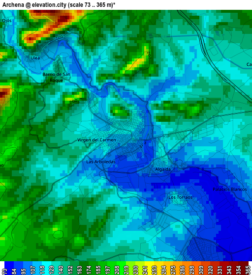
Below is the Elevation map of Archena, which displays elevation range with different colors. Scale of the first map is from 73 to 365 m (240 to 1198 ft) with average elevation of 138.9 meters (=456 ft) [note 1]
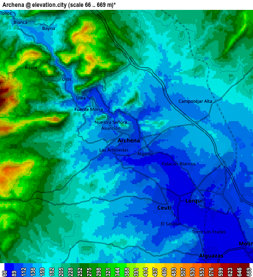
These maps also provides idea of topography and contour of this city, they are displayed at different zoom levels. More info about maps, scale and edge coordinates you can find below images.
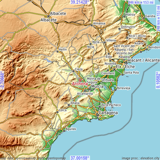
| \ | Map #1 | Map #2 | Topo.Map |
| Scale [m] | 73..365 m | 66..669 m | × |
| Scale [ft] | 240..1198 ft | 217..2195 ft | × |
| Average | 138.9 m = 456 ft | 190.6 m = 625 ft | × |
| Width | 7.69 km = 4.8 mi | 15.38 km = 9.6 mi | 246 km = 152.9 mi |
| Height | 7.69 km = 4.8 mi | 15.38 km = 9.6 mi | 246 km = 152.9 mi |
| ↑Max Latitude | 38.150876° | 38.185426° | 39.21428° |
| Latitude at center | 38.11631° | 38.11631° | 38.11631° |
| ↓Min Latitude | 38.081727° | 38.047128° | 37.00158° |
| ← Min Longitude | -1.344375° | -1.388321° | -2.70668° |
| Longitude center | -1.30043° | -1.30043° | -1.30043° |
| →Max Longitude | -1.256485° | -1.212539° | 0.10582° |
Nearby cities:
Cities around Archena sort by population:
• Molina de Segura elevation 108 m
10.6 km,  130°
130°
• Las Torres de Cotillas 87 m
11.1 km,  152°
152°
• Abarán 188 m
13.1 km,  318°
318°
• Ceuti 95 m
4.8 km, 151°
• Alguazas 100 m
8.2 km, 147°
• Lorquí 114 m
5.7 km, 130°
• Blanca 151 m
9.5 km, 317°
• Campos del Río 182 m
9.7 km,  208°
208°
• Albudeite 178 m
12.3 km,  217°
217°
• Ricote 294 m
7 km,  305°
305°
• Ulea 132 m
3.7 km, 315°
• Ojós 124 m
5 km, 312°
Multilingual:
 En español:
Archena elevación 118 m.
 En France:
Archena élévation 118 m.


Sources and notes:
- [note 1] Map square and city borders are not equal. Map elevation data is calculated only from area inside that square.
- [src 1] Elevation data from geonames database provided with same terms of usage.
- [src 2] The elevation map of Archena is generated using elevation data from NASA's 3 arcsec (90m) resolution SRTM data.
- [src 3] Base (background) map © OpenStreetMap contributors tiles are generated by Geofabrik and OpenTopoMap.
Copyright & License:
This Archena Elevation Map is licensed under CC BY-SA. You may reuse any part from this page, if you give a proper credit by linking to this URL:
 More info on terms of use page.