Azuaga elevation
Azuaga (Extremadura, Provincia de Badajoz), Spain elevation is 583 meters and Azuaga elevation in feet is 1913 ft above sea level [src 1]. Azuaga is a seat of a third-order administrative division (feature code) with elevation that is 20 meters (66 ft) smaller than average city elevation in Spain.
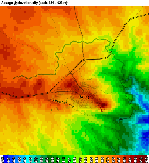
Below is the Elevation map of Azuaga, which displays elevation range with different colors. Scale of the first map is from 434 to 623 m (1424 to 2044 ft) with average elevation of 551.2 meters (=1808 ft) [note 1]
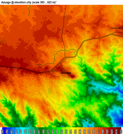
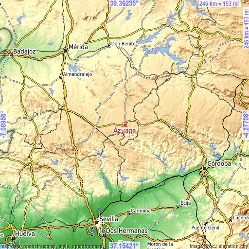
These maps also provides idea of topography and contour of this city, they are displayed at different zoom levels. More info about maps, scale and edge coordinates you can find below images.
| \ | Map #1 | Map #2 | Topo.Map |
| Scale [m] | 434..623 m | 383..623 m | × |
| Scale [ft] | 1424..2044 ft | 1257..2044 ft | × |
| Average | 551.2 m = 1808 ft | 542.3 m = 1779 ft | × |
| Width | 7.67 km = 4.8 mi | 15.35 km = 9.5 mi | 245.5 km = 152.5 mi |
| Height | 7.67 km = 4.8 mi | 15.35 km = 9.5 mi | 245.5 km = 152.5 mi |
| ↑Max Latitude | 38.301165° | 38.335643° | 39.36235° |
| Latitude at center | 38.26667° | 38.26667° | 38.26667° |
| ↓Min Latitude | 38.232159° | 38.197631° | 37.15421° |
| ← Min Longitude | -5.727275° | -5.771221° | -7.08958° |
| Longitude center | -5.68333° | -5.68333° | -5.68333° |
| →Max Longitude | -5.639385° | -5.595439° | -4.27708° |
Nearby cities:
Cities around Azuaga sort by population:
• Fuente Obejuna elevation 610 m
23.3 km,  90°
90°
• Berlanga 543 m
11.8 km,  279°
279°
• Granja de Torrehermosa 565 m
10.3 km,  57°
57°
• Maguilla 546 m
17.2 km,  310°
310°
• Ahillones 594 m
14.6 km,  270°
270°
• Valverde de Llerena 601 m
12.9 km,  244°
244°
• Malcocinado 638 m
16.7 km,  180°
180°
• Casas de Reina 639 m
25.8 km,  253°
253°
• Reina 697 m
25.1 km, 248°
• Trasierra 651 m
29.2 km, 251°
• Alanís 670 m
26.1 km,  186°
186°
• Guadalcanal 745 m
21.9 km,  212°
212°
Multilingual:
 En español:
Azuaga elevación 583 m.
 En France:
Azuaga élévation 583 m.


Sources and notes:
- [note 1] Map square and city borders are not equal. Map elevation data is calculated only from area inside that square.
- [src 1] Elevation data from geonames database provided with same terms of usage.
- [src 2] The elevation map of Azuaga is generated using elevation data from NASA's 3 arcsec (90m) resolution SRTM data.
- [src 3] Base (background) map © OpenStreetMap contributors tiles are generated by Geofabrik and OpenTopoMap.
Copyright & License:
This Azuaga Elevation Map is licensed under CC BY-SA. You may reuse any part from this page, if you give a proper credit by linking to this URL:
 More info on terms of use page.