Beniarrés elevation
Beniarrés (Valencia, Provincia de Alicante), Spain elevation is 395 meters and Beniarrés elevation in feet is 1296 ft above sea level [src 1]. Beniarrés is a seat of a third-order administrative division (feature code) with elevation that is 208 meters (682 ft) smaller than average city elevation in Spain.
Below is the Elevation map of Beniarrés, which displays elevation range with different colors. Scale of the first map is from 259 to 1005 m (850 to 3297 ft) with average elevation of 439.4 meters (=1442 ft) [note 1]
These maps also provides idea of topography and contour of this city, they are displayed at different zoom levels. More info about maps, scale and edge coordinates you can find below images.
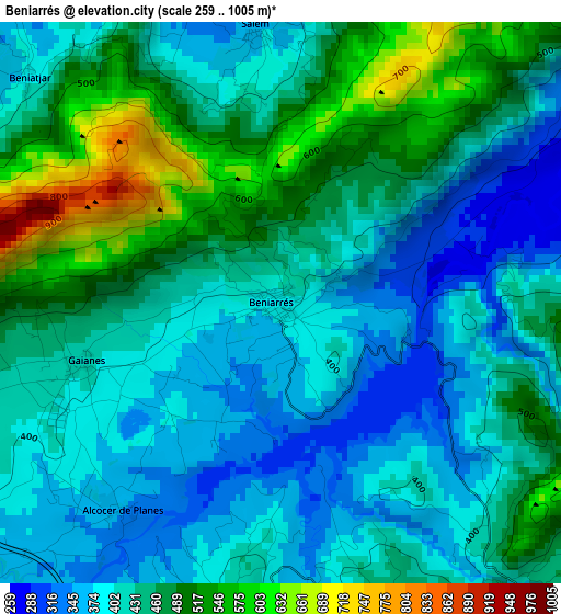
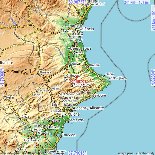
| \ | Map #1 | Topo.Map |
| Scale [m] | 259..1005 m | × |
| Scale [ft] | 850..3297 ft | × |
| Average | 439.4 m = 1442 ft | × |
| Width | 7.61 km = 4.7 mi | 243.6 km = 151.4 mi |
| Height | 7.61 km = 4.7 mi | 243.6 km = 151.4 mi |
| ↑Max Latitude | 38.85442° | 39.90737° |
| Latitude at center | 38.82019° | 38.82019° |
| ↓Min Latitude | 38.785943° | 37.71615° |
| ← Min Longitude | -0.421355° | -1.78366° |
| Longitude center | -0.37741° | -0.37741° |
| →Max Longitude | -0.333465° | 1.02884° |
Nearby cities:
Cities around Beniarrés sort by population:
• Muro del Alcoy elevation 399 m
6.7 km,  229°
229°
• Castelló de Rugat 327 m
7.1 km,  7°
7°
• Planes 443 m
4.9 km,  142°
142°
• Bèlgida 275 m
8.4 km,  293°
293°
• Otos 331 m
6.9 km,  303°
303°
• Benimarfull 420 m
5.1 km,  193°
193°
• Ráfol de Salem 293 m
5.5 km,  339°
339°
• Beniatjar 393 m
4.6 km,  311°
311°
• Rugat 292 m
6.7 km, 12°
• Alcocer de Planes 354 m
3.5 km,  217°
217°
• Almudaina 581 m
7.1 km,  161°
161°
• Benillup 553 m
7.4 km,  181°
181°
Multilingual:
 En español:
Beniarrés elevación 395 m.
 En France:
Beniarrés élévation 395 m.
 Auf Deutsch:
Beniarrés höhe über dem Meeresspiegel ist 395 m.

Sources and notes:
- [note 1] Map square and city borders are not equal. Map elevation data is calculated only from area inside that square.
- [src 1] Elevation data from geonames database provided with same terms of usage.
- [src 2] The elevation map of Beniarrés is generated using elevation data from NASA's 3 arcsec (90m) resolution SRTM data.
- [src 3] Base (background) map © OpenStreetMap contributors tiles are generated by Geofabrik and OpenTopoMap.
Copyright & License:
This Beniarrés Elevation Map is licensed under CC BY-SA. You may reuse any part from this page, if you give a proper credit by linking to this URL:
 More info on terms of use page.