Chimeneas elevation
Chimeneas (Andalusia, Provincia de Granada), Spain elevation is 699 meters and Chimeneas elevation in feet is 2293 ft above sea level [src 1]. Chimeneas is a seat of a third-order administrative division (feature code) with elevation that is 96 meters (315 ft) bigger than average city elevation in Spain.
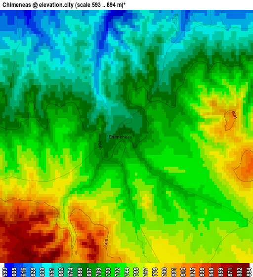
Below is the Elevation map of Chimeneas, which displays elevation range with different colors. Scale of the first map is from 593 to 894 m (1946 to 2933 ft) with average elevation of 721.8 meters (=2368 ft) [note 1]
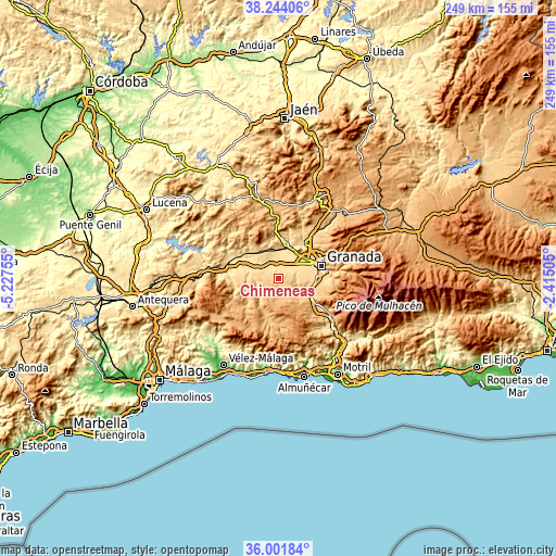
These maps also provides idea of topography and contour of this city, they are displayed at different zoom levels. More info about maps, scale and edge coordinates you can find below images.
| \ | Map #1 | Topo.Map |
| Scale [m] | 593..894 m | × |
| Scale [ft] | 1946..2933 ft | × |
| Average | 721.8 m = 2368 ft | × |
| Width | 7.79 km = 4.8 mi | 249.3 km = 154.9 mi |
| Height | 7.79 km = 4.8 mi | 249.3 km = 154.9 mi |
| ↑Max Latitude | 37.166278° | 38.24406° |
| Latitude at center | 37.13125° | 37.13125° |
| ↓Min Latitude | 37.096206° | 36.00184° |
| ← Min Longitude | -3.865245° | -5.22755° |
| Longitude center | -3.8213° | -3.8213° |
| →Max Longitude | -3.777355° | -2.41505° |
Nearby cities:
Cities around Chimeneas sort by population:
• Las Gabias elevation 686 m
13.4 km,  87°
87°
• Santafé 582 m
11.1 km,  54°
54°
• Cúllar-Vega 643 m
13.6 km,  79°
79°
• Chauchina 553 m
8.8 km,  30°
30°
• Fuente Vaqueros 546 m
10.5 km,  18°
18°
• Láchar 559 m
7.2 km,  351°
351°
• Moraleda de Zafayona 616 m
13.4 km,  287°
287°
• Cijuela 542 m
7.5 km,  6°
6°
• Escúzar 874 m
9.3 km,  145°
145°
• Ventas de Huelma 858 m
7 km,  178°
178°
• Agrón 1051 m
11.3 km, 183°
• Valderrubio 548 m
11.4 km,  0°
0°
Multilingual:
 En español:
Chimeneas elevación 699 m.
 En France:
Chimeneas élévation 699 m.
 Auf Deutsch:
Chimeneas höhe über dem Meeresspiegel ist 699 m.

Sources and notes:
- [note 1] Map square and city borders are not equal. Map elevation data is calculated only from area inside that square.
- [src 1] Elevation data from geonames database provided with same terms of usage.
- [src 2] The elevation map of Chimeneas is generated using elevation data from NASA's 3 arcsec (90m) resolution SRTM data.
- [src 3] Base (background) map © OpenStreetMap contributors tiles are generated by Geofabrik and OpenTopoMap.
Copyright & License:
This Chimeneas Elevation Map is licensed under CC BY-SA. You may reuse any part from this page, if you give a proper credit by linking to this URL:
 More info on terms of use page.