Fuenteheridos elevation
Fuenteheridos (Andalusia, Provincia de Huelva), Spain elevation is 716 meters and Fuenteheridos elevation in feet is 2349 ft above sea level [src 1]. Fuenteheridos is a seat of a third-order administrative division (feature code) with elevation that is 113 meters (371 ft) bigger than average city elevation in Spain.
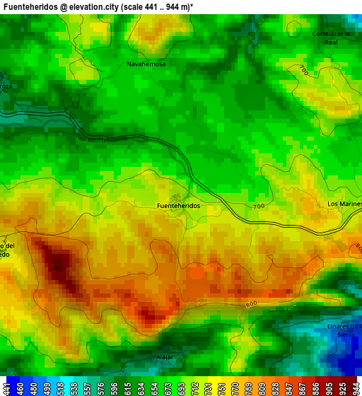
Below is the Elevation map of Fuenteheridos, which displays elevation range with different colors. Scale of the first map is from 441 to 944 m (1447 to 3097 ft) with average elevation of 698.9 meters (=2293 ft) [note 1]
These maps also provides idea of topography and contour of this city, they are displayed at different zoom levels. More info about maps, scale and edge coordinates you can find below images.
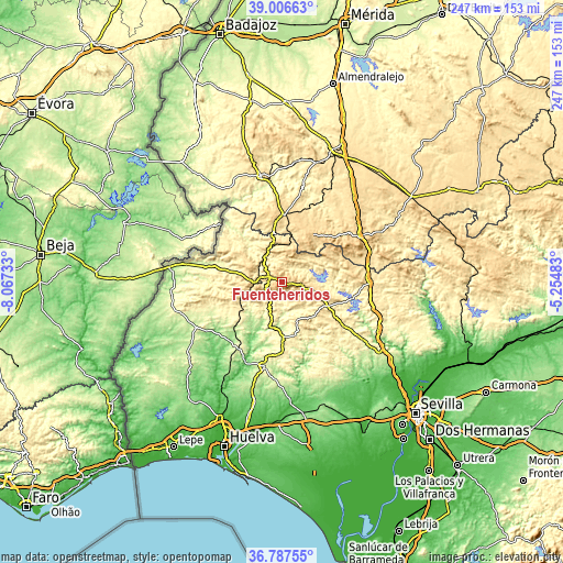
| \ | Map #1 | Topo.Map |
| Scale [m] | 441..944 m | × |
| Scale [ft] | 1447..3097 ft | × |
| Average | 698.9 m = 2293 ft | × |
| Width | 7.71 km = 4.8 mi | 246.7 km = 153.3 mi |
| Height | 7.71 km = 4.8 mi | 246.7 km = 153.3 mi |
| ↑Max Latitude | 37.940116° | 39.00663° |
| Latitude at center | 37.90545° | 37.90545° |
| ↓Min Latitude | 37.870768° | 36.78755° |
| ← Min Longitude | -6.705025° | -8.06733° |
| Longitude center | -6.66108° | -6.66108° |
| →Max Longitude | -6.617135° | -5.25483° |
Nearby cities:
Cities around Fuenteheridos sort by population:
• Aracena elevation 675 m
8.9 km,  98°
98°
• Campofrío 523 m
17.3 km,  153°
153°
• Corteconcepción 504 m
14.1 km,  92°
92°
• Cortegana 673 m
14 km,  272°
272°
• Hinojales 519 m
12.5 km,  32°
32°
• Santa Ana la Real 641 m
7.3 km,  229°
229°
• Jabugo 658 m
6.1 km,  281°
281°
• Valdelarco 624 m
5.2 km,  339°
339°
• Galaroza 577 m
4.8 km,  302°
302°
• Cortelazor 617 m
4.7 km,  42°
42°
• Linares de la Sierra 502 m
4.4 km,  130°
130°
• Alájar 580 m
3.5 km,  186°
186°
Multilingual:
 En español:
Fuenteheridos elevación 716 m.
 En France:
Fuenteheridos élévation 716 m.
 Auf Deutsch:
Fuenteheridos höhe über dem Meeresspiegel ist 716 m.

Sources and notes:
- [note 1] Map square and city borders are not equal. Map elevation data is calculated only from area inside that square.
- [src 1] Elevation data from geonames database provided with same terms of usage.
- [src 2] The elevation map of Fuenteheridos is generated using elevation data from NASA's 3 arcsec (90m) resolution SRTM data.
- [src 3] Base (background) map © OpenStreetMap contributors tiles are generated by Geofabrik and OpenTopoMap.
Copyright & License:
This Fuenteheridos Elevation Map is licensed under CC BY-SA. You may reuse any part from this page, if you give a proper credit by linking to this URL:
 More info on terms of use page.