Gandia elevation
Gandia (Valencia, Província de València), Spain elevation is 34 meters and Gandia elevation in feet is 112 ft above sea level [src 1]. Gandia is a seat of a third-order administrative division (feature code) with elevation that is 569 meters (1867 ft) smaller than average city elevation in Spain.
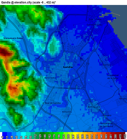
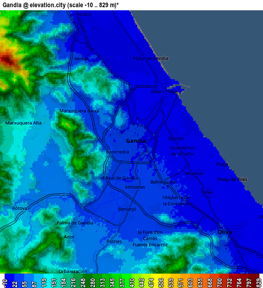
Below is the Elevation map of Gandia, which displays elevation range with different colors. Scale of the first map is from -6 to 432 m (-20 to 1417 ft) with average elevation of 59.3 meters (=195 ft) [note 1]
These maps also provides idea of topography and contour of this city, they are displayed at different zoom levels. More info about maps, scale and edge coordinates you can find below images.
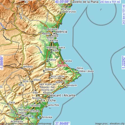
| \ | Map #1 | Map #2 | Topo.Map |
| Scale [m] | -6..432 m | -10..829 m | × |
| Scale [ft] | -20..1417 ft | -33..2720 ft | × |
| Average | 59.3 m = 195 ft | 95.9 m = 315 ft | × |
| Width | 7.6 km = 4.7 mi | 15.2 km = 9.4 mi | 243.1 km = 151.1 mi |
| Height | 7.6 km = 4.7 mi | 15.2 km = 9.4 mi | 243.1 km = 151.1 mi |
| ↑Max Latitude | 39.00083° | 39.034973° | 40.05159° |
| Latitude at center | 38.96667° | 38.96667° | 38.96667° |
| ↓Min Latitude | 38.932494° | 38.898301° | 37.86488° |
| ← Min Longitude | -0.227275° | -0.271221° | -1.58958° |
| Longitude center | -0.18333° | -0.18333° | -0.18333° |
| →Max Longitude | -0.139385° | -0.095439° | 1.22292° |
Nearby cities:
Cities around Gandia sort by population:
• Bellreguard elevation 24 m
2.3 km,  142°
142°
• Piles 15 m
5.2 km,  122°
122°
• Daimús 8 m
2.9 km,  90°
90°
• Real de Gandía 44 m
2.2 km,  200°
200°
• Miramar 13 m
4.2 km, 115°
• Almoines 40 m
2.6 km,  176°
176°
• L'Alqueria de la Comtessa 21 m
4.7 km, 142°
• Benirredrà 34 m
0 km,  0°
0°
• Beniarjó 48 m
3.8 km, 183°
• Rafelcofer 40 m
4 km,  160°
160°
• Palmera 24 m
4 km, 140°
• Beniflá 43 m
4.3 km,  174°
174°
Multilingual:
 En español:
Gandía elevación 34 m.
 En France:
Gandie élévation 34 m.


Sources and notes:
- [note 1] Map square and city borders are not equal. Map elevation data is calculated only from area inside that square.
- [src 1] Elevation data from geonames database provided with same terms of usage.
- [src 2] The elevation map of Gandia is generated using elevation data from NASA's 3 arcsec (90m) resolution SRTM data.
- [src 3] Base (background) map © OpenStreetMap contributors tiles are generated by Geofabrik and OpenTopoMap.
Copyright & License:
This Gandia Elevation Map is licensed under CC BY-SA. You may reuse any part from this page, if you give a proper credit by linking to this URL:
 More info on terms of use page.