Hontecillas elevation
Hontecillas (Castille-La Mancha, Provincia de Cuenca), Spain elevation is 835 meters and Hontecillas elevation in feet is 2740 ft above sea level [src 1]. Hontecillas is a seat of a third-order administrative division (feature code) with elevation that is 232 meters (761 ft) bigger than average city elevation in Spain.
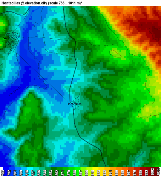
Below is the Elevation map of Hontecillas, which displays elevation range with different colors. Scale of the first map is from 783 to 1011 m (2569 to 3317 ft) with average elevation of 856.8 meters (=2811 ft) [note 1]
These maps also provides idea of topography and contour of this city, they are displayed at different zoom levels. More info about maps, scale and edge coordinates you can find below images.
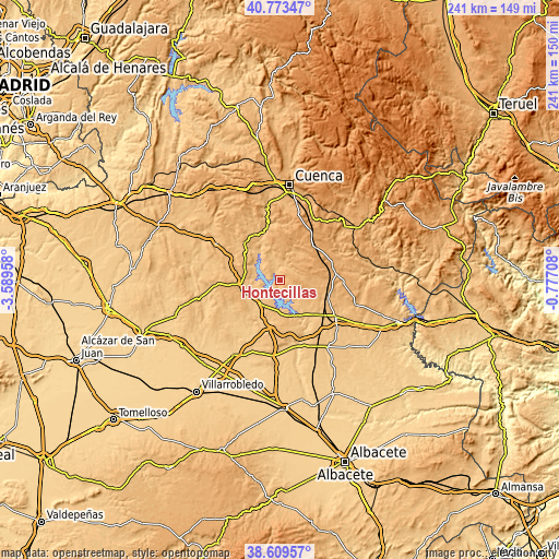
| \ | Map #1 | Topo.Map |
| Scale [m] | 783..1011 m | × |
| Scale [ft] | 2569..3317 ft | × |
| Average | 856.8 m = 2811 ft | × |
| Width | 7.52 km = 4.7 mi | 240.6 km = 149.5 mi |
| Height | 7.52 km = 4.7 mi | 240.6 km = 149.5 mi |
| ↑Max Latitude | 39.733803° | 40.77347° |
| Latitude at center | 39.7° | 39.7° |
| ↓Min Latitude | 39.66618° | 38.60957° |
| ← Min Longitude | -2.227275° | -3.58958° |
| Longitude center | -2.18333° | -2.18333° |
| →Max Longitude | -2.139385° | -0.77708° |
Nearby cities:
Cities around Hontecillas sort by population:
• Honrubia elevation 817 m
12.7 km,  220°
220°
• Valverde de Júcar 845 m
3.9 km,  302°
302°
• Buenache de Alarcón 829 m
5.7 km,  165°
165°
• Olivares de Júcar 921 m
16.2 km,  294°
294°
• Villaverde y Pasaconsol 861 m
10.6 km,  318°
318°
• Albaladejo del Cuende 882 m
12.5 km,  341°
341°
• Olmeda del Rey 960 m
14 km,  37°
37°
• Olmedilla de Alarcón 842 m
11.7 km,  142°
142°
• Barchín del Hoyo 962 m
10.6 km,  110°
110°
• Piqueras del Castillo 949 m
10.1 km,  79°
79°
• Chumillas 1033 m
14.8 km,  59°
59°
• Torrubia del Castillo 849 m
11.9 km,  247°
247°
Multilingual:
 En español:
Hontecillas elevación 835 m.
 En France:
Hontecillas élévation 835 m.
 Auf Deutsch:
Hontecillas höhe über dem Meeresspiegel ist 835 m.

Sources and notes:
- [note 1] Map square and city borders are not equal. Map elevation data is calculated only from area inside that square.
- [src 1] Elevation data from geonames database provided with same terms of usage.
- [src 2] The elevation map of Hontecillas is generated using elevation data from NASA's 3 arcsec (90m) resolution SRTM data.
- [src 3] Base (background) map © OpenStreetMap contributors tiles are generated by Geofabrik and OpenTopoMap.
Copyright & License:
This Hontecillas Elevation Map is licensed under CC BY-SA. You may reuse any part from this page, if you give a proper credit by linking to this URL:
 More info on terms of use page.