Lepe elevation
Lepe (Andalusia, Provincia de Huelva), Spain elevation is 24 meters and Lepe elevation in feet is 79 ft above sea level [src 1]. Lepe is a seat of a third-order administrative division (feature code) with elevation that is 579 meters (1900 ft) smaller than average city elevation in Spain.
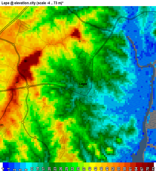
Below is the Elevation map of Lepe, which displays elevation range with different colors. Scale of the first map is from -4 to 73 m (-13 to 240 ft) with average elevation of 27.7 meters (=91 ft) [note 1]
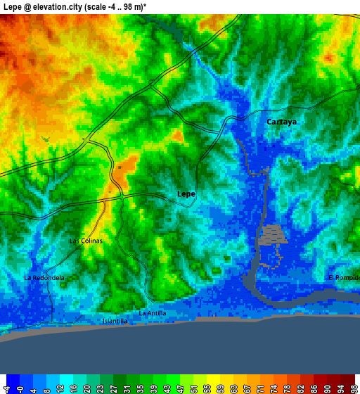
These maps also provides idea of topography and contour of this city, they are displayed at different zoom levels. More info about maps, scale and edge coordinates you can find below images.
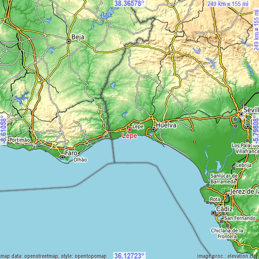
| \ | Map #1 | Map #2 | Topo.Map |
| Scale [m] | -4..73 m | -4..98 m | × |
| Scale [ft] | -13..240 ft | -13..322 ft | × |
| Average | 27.7 m = 91 ft | 31 m = 102 ft | × |
| Width | 7.78 km = 4.8 mi | 15.56 km = 9.7 mi | 248.9 km = 154.7 mi |
| Height | 7.78 km = 4.8 mi | 15.56 km = 9.7 mi | 248.9 km = 154.7 mi |
| ↑Max Latitude | 37.28979° | 37.324744° | 38.36578° |
| Latitude at center | 37.25482° | 37.25482° | 37.25482° |
| ↓Min Latitude | 37.219834° | 37.184831° | 36.12723° |
| ← Min Longitude | -7.248275° | -7.292221° | -8.61058° |
| Longitude center | -7.20433° | -7.20433° | -7.20433° |
| →Max Longitude | -7.160385° | -7.116439° | -5.79808° |
Nearby cities:
Cities around Lepe sort by population:
• Huelva elevation 34 m
23.4 km,  86°
86°
• Isla Cristina 7 m
11.7 km,  238°
238°
• Ayamonte 12 m
18.6 km,  255°
255°
• Aljaraque 30 m
16.1 km,  84°
84°
• Cartaya 16 m
5.6 km,  58°
58°
• Punta Umbría 10 m
22.6 km,  110°
110°
• La Antilla 9 m
5.3 km,  184°
184°
• San Bartolomé de la Torre 130 m
22.9 km,  22°
22°
• Villablanca 87 m
13.5 km,  293°
293°
• El Rompido 7 m
8.4 km,  119°
119°
• Islantilla 16 m
6.2 km,  208°
208°
• San Silvestre de Guzmán 152 m
19.5 km,  319°
319°
Multilingual:
 En español:
Lepe elevación 24 m.
 En France:
Lepe élévation 24 m.


Sources and notes:
- [note 1] Map square and city borders are not equal. Map elevation data is calculated only from area inside that square.
- [src 1] Elevation data from geonames database provided with same terms of usage.
- [src 2] The elevation map of Lepe is generated using elevation data from NASA's 3 arcsec (90m) resolution SRTM data.
- [src 3] Base (background) map © OpenStreetMap contributors tiles are generated by Geofabrik and OpenTopoMap.
Copyright & License:
This Lepe Elevation Map is licensed under CC BY-SA. You may reuse any part from this page, if you give a proper credit by linking to this URL:
 More info on terms of use page.