Miguel Esteban elevation
Miguel Esteban (Castille-La Mancha, Province of Toledo), Spain elevation is 681 meters and Miguel Esteban elevation in feet is 2234 ft above sea level [src 1]. Miguel Esteban is a seat of a third-order administrative division (feature code) with elevation that is 78 meters (256 ft) bigger than average city elevation in Spain.
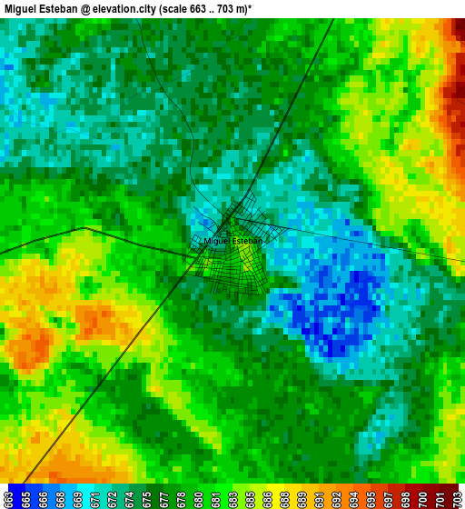
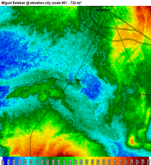
Below is the Elevation map of Miguel Esteban, which displays elevation range with different colors. Scale of the first map is from 663 to 703 m (2175 to 2306 ft) with average elevation of 678.4 meters (=2226 ft) [note 1]
These maps also provides idea of topography and contour of this city, they are displayed at different zoom levels. More info about maps, scale and edge coordinates you can find below images.
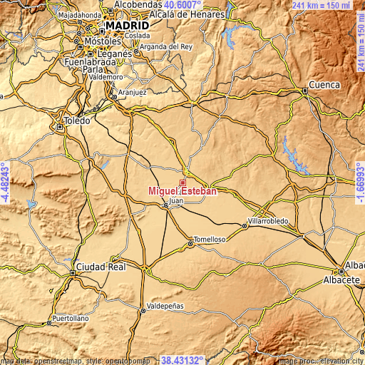
| \ | Map #1 | Map #2 | Topo.Map |
| Scale [m] | 663..703 m | 661..732 m | × |
| Scale [ft] | 2175..2306 ft | 2169..2402 ft | × |
| Average | 678.4 m = 2226 ft | 685.4 m = 2249 ft | × |
| Width | 7.54 km = 4.7 mi | 15.08 km = 9.4 mi | 241.2 km = 149.9 mi |
| Height | 7.54 km = 4.7 mi | 15.08 km = 9.4 mi | 241.2 km = 149.9 mi |
| ↑Max Latitude | 39.558369° | 39.592242° | 40.6007° |
| Latitude at center | 39.52448° | 39.52448° | 39.52448° |
| ↓Min Latitude | 39.490574° | 39.456652° | 38.43132° |
| ← Min Longitude | -3.120125° | -3.164071° | -4.48243° |
| Longitude center | -3.07618° | -3.07618° | -3.07618° |
| →Max Longitude | -3.032235° | -2.988289° | -1.66993° |
Nearby cities:
Cities around Miguel Esteban sort by population:
• Alcázar de San Juan elevation 649 m
18.8 km,  217°
217°
• Campo de Criptana 711 m
14 km,  197°
197°
• Quintanar de la Orden 692 m
8.2 km,  21°
21°
• Villacañas 677 m
25 km,  296°
296°
• Pedro Muñoz 666 m
17.5 km,  140°
140°
• Mota del Cuervo 710 m
17.9 km,  98°
98°
• La Puebla de Almoradiel 695 m
9 km,  336°
336°
• Villa de Don Fadrique 672 m
15.9 km,  309°
309°
• Villanueva de Alcardete 729 m
17.4 km, 17°
• El Toboso 698 m
6.9 km, 100°
• Quero 654 m
14.8 km,  264°
264°
• Los Hinojosos 772 m
23.2 km,  67°
67°
Multilingual:
 En español:
Miguel Esteban elevación 681 m.
 En France:
Miguel Esteban élévation 681 m.
 Auf Deutsch:
Miguel Esteban höhe über dem Meeresspiegel ist 681 m.

Sources and notes:
- [note 1] Map square and city borders are not equal. Map elevation data is calculated only from area inside that square.
- [src 1] Elevation data from geonames database provided with same terms of usage.
- [src 2] The elevation map of Miguel Esteban is generated using elevation data from NASA's 3 arcsec (90m) resolution SRTM data.
- [src 3] Base (background) map © OpenStreetMap contributors tiles are generated by Geofabrik and OpenTopoMap.
Copyright & License:
This Miguel Esteban Elevation Map is licensed under CC BY-SA. You may reuse any part from this page, if you give a proper credit by linking to this URL:
 More info on terms of use page.