Mogán elevation
Mogán (Canary Islands, Provincia de Las Palmas), Spain elevation is 238 meters and Mogán elevation in feet is 781 ft above sea level [src 1]. Mogán is a seat of a third-order administrative division (feature code) with elevation that is 365 meters (1198 ft) smaller than average city elevation in Spain.
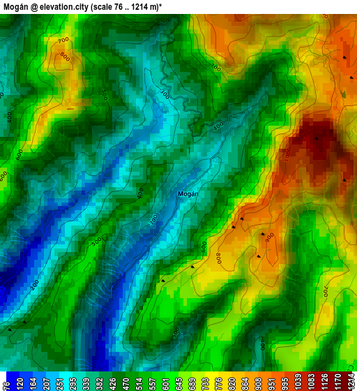
Below is the Elevation map of Mogán, which displays elevation range with different colors. Scale of the first map is from 76 to 1214 m (249 to 3983 ft) with average elevation of 534.2 meters (=1753 ft) [note 1]
These maps also provides idea of topography and contour of this city, they are displayed at different zoom levels. More info about maps, scale and edge coordinates you can find below images.
| \ | Map #1 | Map #2 | Topo.Map |
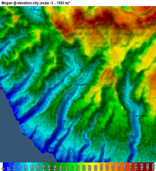
| Scale [m] | 76..1214 m | -3..1553 m | × |
| Scale [ft] | 249..3983 ft | -10..5095 ft | × |
| Average | 534.2 m = 1753 ft | 587.7 m = 1928 ft | × |
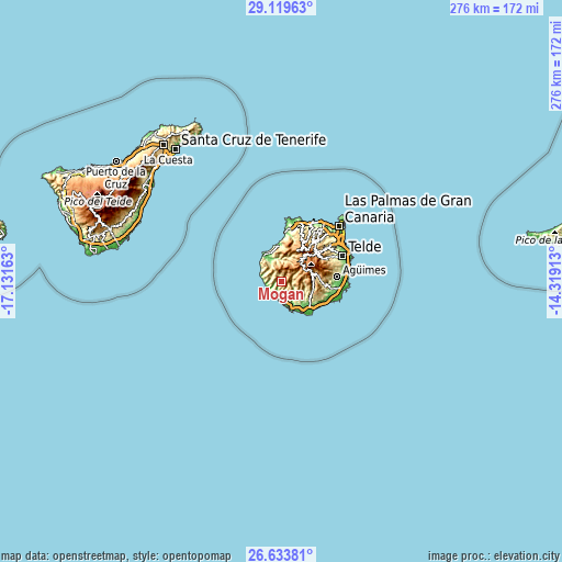
| Width | 8.64 km = 5.4 mi | 17.28 km = 10.7 mi | 276.4 km = 171.7 mi |
| Height | 8.64 km = 5.4 mi | 17.28 km = 10.7 mi | 276.4 km = 171.7 mi |
| ↑Max Latitude | 27.922686° | 27.961508° | 29.11963° |
| Latitude at center | 27.88385° | 27.88385° | 27.88385° |
| ↓Min Latitude | 27.845° | 27.806136° | 26.63381° |
| ← Min Longitude | -15.769325° | -15.813271° | -17.13163° |
| Longitude center | -15.72538° | -15.72538° | -15.72538° |
| →Max Longitude | -15.681435° | -15.637489° | -14.31913° |
Nearby cities:
Cities around Mogán sort by population:
• Santa Lucía elevation 699 m
18.4 km,  80°
80°
• San Bartolomé de Tirajana 902 m
15.6 km,  73°
73°
• Maspalomas 32 m
19.4 km,  135°
135°
• Playa del Ingles 49 m
20.2 km,  134°
134°
• Puerto Rico 25 m
10.6 km,  172°
172°
• Valsequillo de Gran Canaria 601 m
25.1 km,  63°
63°
• San Nicolás 57 m
12.9 km,  334°
334°
• Vega de San Mateo 848 m
23.4 km,  53°
53°
• Agaete 55 m
24.2 km,  5°
5°
• Valleseco 1067 m
23 km,  39°
39°
• Tejeda 1046 m
16.4 km, 41°
• Artenara 1235 m
17 km,  26°
26°
Multilingual:
 En español:
Mogán elevación 238 m.
 En France:
Mogán élévation 238 m.


Sources and notes:
- [note 1] Map square and city borders are not equal. Map elevation data is calculated only from area inside that square.
- [src 1] Elevation data from geonames database provided with same terms of usage.
- [src 2] The elevation map of Mogán is generated using elevation data from NASA's 3 arcsec (90m) resolution SRTM data.
- [src 3] Base (background) map © OpenStreetMap contributors tiles are generated by Geofabrik and OpenTopoMap.
Copyright & License:
This Mogán Elevation Map is licensed under CC BY-SA. You may reuse any part from this page, if you give a proper credit by linking to this URL:
 More info on terms of use page.