Moguer elevation
Moguer (Andalusia, Provincia de Huelva), Spain elevation is 54 meters and Moguer elevation in feet is 177 ft above sea level [src 1]. Moguer is a seat of a third-order administrative division (feature code) with elevation that is 549 meters (1801 ft) smaller than average city elevation in Spain.
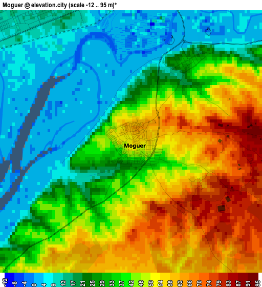
Below is the Elevation map of Moguer, which displays elevation range with different colors. Scale of the first map is from -12 to 95 m (-39 to 312 ft) with average elevation of 35.8 meters (=117 ft) [note 1]
These maps also provides idea of topography and contour of this city, they are displayed at different zoom levels. More info about maps, scale and edge coordinates you can find below images.
| \ | Map #1 | Map #2 | Topo.Map |
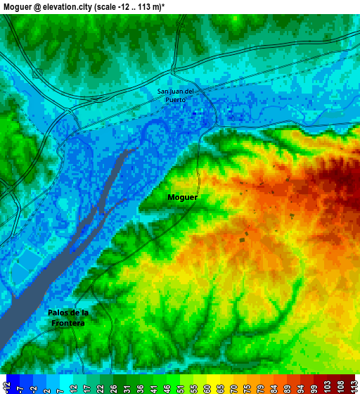
| Scale [m] | -12..95 m | -12..113 m | × |
| Scale [ft] | -39..312 ft | -39..371 ft | × |
| Average | 35.8 m = 117 ft | 33.8 m = 111 ft | × |
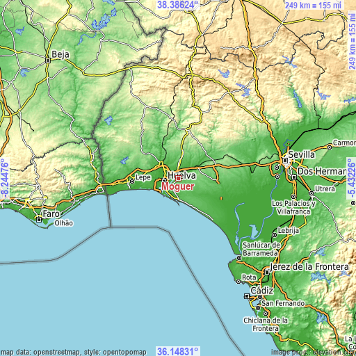
| Width | 7.78 km = 4.8 mi | 15.55 km = 9.7 mi | 248.8 km = 154.6 mi |
| Height | 7.78 km = 4.8 mi | 15.55 km = 9.7 mi | 248.8 km = 154.6 mi |
| ↑Max Latitude | 37.310551° | 37.345495° | 38.38624° |
| Latitude at center | 37.27559° | 37.27559° | 37.27559° |
| ↓Min Latitude | 37.240613° | 37.20562° | 36.14831° |
| ← Min Longitude | -6.882455° | -6.926401° | -8.24476° |
| Longitude center | -6.83851° | -6.83851° | -6.83851° |
| →Max Longitude | -6.794565° | -6.750619° | -5.43226° |
Nearby cities:
Cities around Moguer sort by population:
• Huelva elevation 34 m
9 km,  263°
263°
• Aljaraque 30 m
16.3 km,  267°
267°
• Punta Umbría 10 m
15.3 km,  227°
227°
• Gibraleón 34 m
16.1 km,  314°
314°
• Palos de la Frontera 9 m
6.7 km, 227°
• Trigueros 75 m
12.3 km,  4°
4°
• San Juan del Puerto 9 m
4.6 km,  356°
356°
• Bonares 87 m
15 km,  68°
68°
• Beas 121 m
17.2 km,  13°
13°
• Mazagón 41 m
15.4 km,  176°
176°
• Niebla 41 m
17.1 km,  55°
55°
• Lucena del Puerto 87 m
10.2 km, 71°
Multilingual:
 En español:
Moguer elevación 54 m.
 En France:
Moguer élévation 54 m.


Sources and notes:
- [note 1] Map square and city borders are not equal. Map elevation data is calculated only from area inside that square.
- [src 1] Elevation data from geonames database provided with same terms of usage.
- [src 2] The elevation map of Moguer is generated using elevation data from NASA's 3 arcsec (90m) resolution SRTM data.
- [src 3] Base (background) map © OpenStreetMap contributors tiles are generated by Geofabrik and OpenTopoMap.
Copyright & License:
This Moguer Elevation Map is licensed under CC BY-SA. You may reuse any part from this page, if you give a proper credit by linking to this URL:
 More info on terms of use page.