Navahermosa elevation
Navahermosa (Castille-La Mancha, Province of Toledo), Spain elevation is 736 meters and Navahermosa elevation in feet is 2415 ft above sea level [src 1]. Navahermosa is a seat of a third-order administrative division (feature code) with elevation that is 133 meters (436 ft) bigger than average city elevation in Spain.
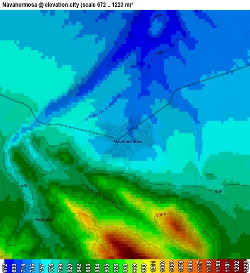
Below is the Elevation map of Navahermosa, which displays elevation range with different colors. Scale of the first map is from 672 to 1223 m (2205 to 4012 ft) with average elevation of 800.3 meters (=2626 ft) [note 1]
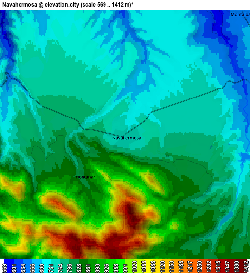
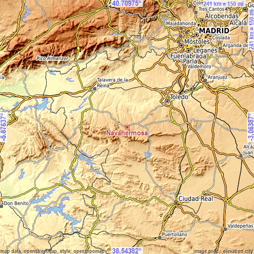
These maps also provides idea of topography and contour of this city, they are displayed at different zoom levels. More info about maps, scale and edge coordinates you can find below images.
| \ | Map #1 | Map #2 | Topo.Map |
| Scale [m] | 672..1223 m | 569..1412 m | × |
| Scale [ft] | 2205..4012 ft | 1867..4633 ft | × |
| Average | 800.3 m = 2626 ft | 817.3 m = 2681 ft | × |
| Width | 7.53 km = 4.7 mi | 15.05 km = 9.4 mi | 240.8 km = 149.6 mi |
| Height | 7.53 km = 4.7 mi | 15.05 km = 9.4 mi | 240.8 km = 149.6 mi |
| ↑Max Latitude | 39.669095° | 39.702913° | 40.70975° |
| Latitude at center | 39.63526° | 39.63526° | 39.63526° |
| ↓Min Latitude | 39.601409° | 39.56754° | 38.54382° |
| ← Min Longitude | -4.514065° | -4.558011° | -5.87637° |
| Longitude center | -4.47012° | -4.47012° | -4.47012° |
| →Max Longitude | -4.426175° | -4.382229° | -3.06387° |
Nearby cities:
Cities around Navahermosa sort by population:
• Gálvez elevation 713 m
18.5 km,  66°
66°
• Menasalbas 709 m
15.9 km,  88°
88°
• Los Navalmorales 667 m
17.8 km,  304°
304°
• Los Navalucillos 747 m
15.1 km,  283°
283°
• Ventas con Peña Aguilera 794 m
20.6 km,  97°
97°
• Cuerva 774 m
22.4 km,  81°
81°
• Retuerta de Bullaque 744 m
19.7 km,  165°
165°
• San Martín de Pusa 503 m
21.6 km,  319°
319°
• San Martín de Montalbán 656 m
10.2 km,  43°
43°
• Navas de Estena 665 m
16.2 km,  195°
195°
• Hontanar 849 m
3.4 km,  222°
222°
• Villarejo de Montalbán 534 m
17.3 km,  329°
329°
Multilingual:
 En español:
Navahermosa elevación 736 m.
 En France:
Navahermosa élévation 736 m.
 Auf Deutsch:
Navahermosa höhe über dem Meeresspiegel ist 736 m.

Sources and notes:
- [note 1] Map square and city borders are not equal. Map elevation data is calculated only from area inside that square.
- [src 1] Elevation data from geonames database provided with same terms of usage.
- [src 2] The elevation map of Navahermosa is generated using elevation data from NASA's 3 arcsec (90m) resolution SRTM data.
- [src 3] Base (background) map © OpenStreetMap contributors tiles are generated by Geofabrik and OpenTopoMap.
Copyright & License:
This Navahermosa Elevation Map is licensed under CC BY-SA. You may reuse any part from this page, if you give a proper credit by linking to this URL:
 More info on terms of use page.