Noalejo elevation
Noalejo (Andalusia, Provincia de Jaén), Spain elevation is 1097 meters and Noalejo elevation in feet is 3599 ft above sea level [src 1]. Noalejo is a seat of a third-order administrative division (feature code) with elevation that is 494 meters (1621 ft) bigger than average city elevation in Spain.
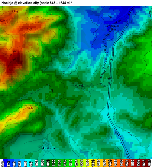
Below is the Elevation map of Noalejo, which displays elevation range with different colors. Scale of the first map is from 843 to 1644 m (2766 to 5394 ft) with average elevation of 1104.8 meters (=3625 ft) [note 1]
These maps also provides idea of topography and contour of this city, they are displayed at different zoom levels. More info about maps, scale and edge coordinates you can find below images.
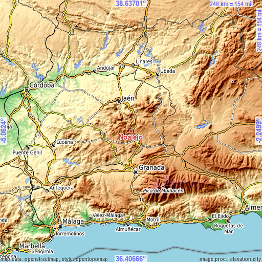
| \ | Map #1 | Topo.Map |
| Scale [m] | 843..1644 m | × |
| Scale [ft] | 2766..5394 ft | × |
| Average | 1104.8 m = 3625 ft | × |
| Width | 7.75 km = 4.8 mi | 248 km = 154.1 mi |
| Height | 7.75 km = 4.8 mi | 248 km = 154.1 mi |
| ↑Max Latitude | 37.565012° | 38.63701° |
| Latitude at center | 37.53017° | 37.53017° |
| ↓Min Latitude | 37.495312° | 36.40666° |
| ← Min Longitude | -3.700095° | -5.0624° |
| Longitude center | -3.65615° | -3.65615° |
| →Max Longitude | -3.612205° | -2.2499° |
Nearby cities:
Cities around Noalejo sort by population:
• Iznalloz elevation 818 m
19 km,  143°
143°
• Valdepeñas de Jaén 963 m
15.4 km,  295°
295°
• Cambil 773 m
18.4 km,  25°
25°
• Montejicar 1146 m
14.1 km,  70°
70°
• Campillo de Arenas 877 m
3.3 km, 33°
• Frailes 972 m
16.7 km,  252°
252°
• Colomera 857 m
18.4 km,  196°
196°
• Campotéjar 923 m
6.3 km,  147°
147°
• Benalúa de las Villas 851 m
11.7 km,  191°
191°
• Montillana 1021 m
3.5 km,  206°
206°
• Domingo Pérez 970 m
13.5 km,  106°
106°
• Dehesas Viejas 1007 m
11.1 km,  124°
124°
Multilingual:
 En español:
Noalejo elevación 1097 m.
 En France:
Noalejo élévation 1097 m.
 Auf Deutsch:
Noalejo höhe über dem Meeresspiegel ist 1097 m.

Sources and notes:
- [note 1] Map square and city borders are not equal. Map elevation data is calculated only from area inside that square.
- [src 1] Elevation data from geonames database provided with same terms of usage.
- [src 2] The elevation map of Noalejo is generated using elevation data from NASA's 3 arcsec (90m) resolution SRTM data.
- [src 3] Base (background) map © OpenStreetMap contributors tiles are generated by Geofabrik and OpenTopoMap.
Copyright & License:
This Noalejo Elevation Map is licensed under CC BY-SA. You may reuse any part from this page, if you give a proper credit by linking to this URL:
 More info on terms of use page.