Portaje elevation
Portaje (Extremadura, Provincia de Cáceres), Spain elevation is 377 meters and Portaje elevation in feet is 1237 ft above sea level [src 1]. Portaje is a seat of a third-order administrative division (feature code) with elevation that is 226 meters (741 ft) smaller than average city elevation in Spain.
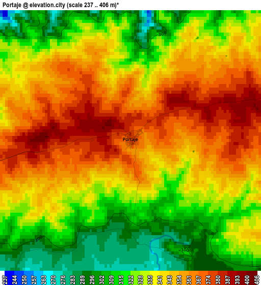
Below is the Elevation map of Portaje, which displays elevation range with different colors. Scale of the first map is from 237 to 406 m (778 to 1332 ft) with average elevation of 338.2 meters (=1110 ft) [note 1]
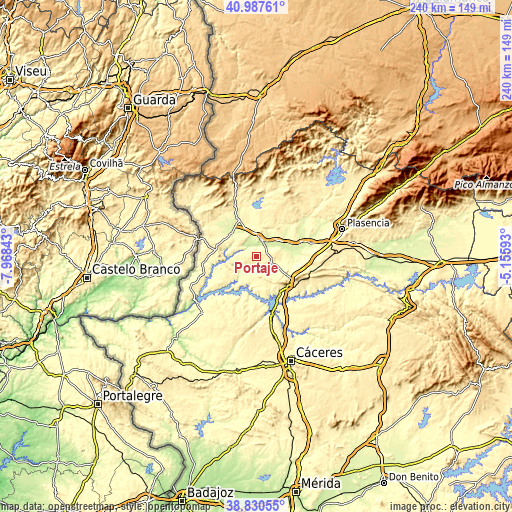
These maps also provides idea of topography and contour of this city, they are displayed at different zoom levels. More info about maps, scale and edge coordinates you can find below images.
| \ | Map #1 | Topo.Map |
| Scale [m] | 237..406 m | × |
| Scale [ft] | 778..1332 ft | × |
| Average | 338.2 m = 1110 ft | × |
| Width | 7.5 km = 4.7 mi | 239.8 km = 149 mi |
| Height | 7.5 km = 4.7 mi | 239.8 km = 149 mi |
| ↑Max Latitude | 39.951266° | 40.98761° |
| Latitude at center | 39.91757° | 39.91757° |
| ↓Min Latitude | 39.883857° | 38.83055° |
| ← Min Longitude | -6.606125° | -7.96843° |
| Longitude center | -6.56218° | -6.56218° |
| →Max Longitude | -6.518235° | -5.15593° |
Nearby cities:
Cities around Portaje sort by population:
• Coria elevation 268 m
7.7 km,  16°
16°
• Torrejoncillo 336 m
8.4 km,  105°
105°
• Holguera 278 m
18.2 km,  96°
96°
• Casillas de Coria 251 m
8.3 km,  309°
309°
• Calzadilla 356 m
16 km,  8°
8°
• Morcillo 272 m
18 km,  51°
51°
• Casas de Don Gómez 324 m
10.7 km,  342°
342°
• Portezuelo 374 m
13.9 km,  147°
147°
• Huélaga 284 m
16 km, 343°
• Pescueza 337 m
7.1 km,  270°
270°
• Pedroso de Acim 464 m
16.4 km,  128°
128°
• Cachorrilla 319 m
9.1 km, 268°
Multilingual:
 En español:
Portaje elevación 377 m.
 En France:
Portaje élévation 377 m.


Sources and notes:
- [note 1] Map square and city borders are not equal. Map elevation data is calculated only from area inside that square.
- [src 1] Elevation data from geonames database provided with same terms of usage.
- [src 2] The elevation map of Portaje is generated using elevation data from NASA's 3 arcsec (90m) resolution SRTM data.
- [src 3] Base (background) map © OpenStreetMap contributors tiles are generated by Geofabrik and OpenTopoMap.
Copyright & License:
This Portaje Elevation Map is licensed under CC BY-SA. You may reuse any part from this page, if you give a proper credit by linking to this URL:
 More info on terms of use page.