Ronda elevation
Ronda (Andalusia, Provincia de Málaga), Spain elevation is 718 meters and Ronda elevation in feet is 2356 ft above sea level [src 1]. Ronda is a seat of a third-order administrative division (feature code) with elevation that is 115 meters (377 ft) bigger than average city elevation in Spain.
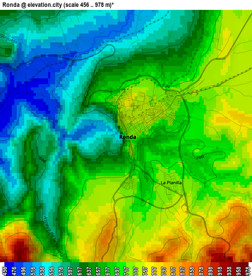
Below is the Elevation map of Ronda, which displays elevation range with different colors. Scale of the first map is from 456 to 978 m (1496 to 3209 ft) with average elevation of 667.4 meters (=2190 ft) [note 1]
These maps also provides idea of topography and contour of this city, they are displayed at different zoom levels. More info about maps, scale and edge coordinates you can find below images.
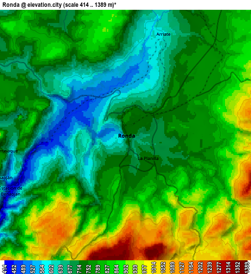
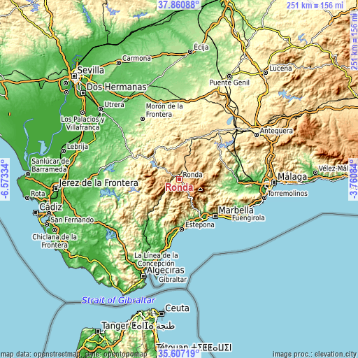
| \ | Map #1 | Map #2 | Topo.Map |
| Scale [m] | 456..978 m | 414..1389 m | × |
| Scale [ft] | 1496..3209 ft | 1358..4557 ft | × |
| Average | 667.4 m = 2190 ft | 787.2 m = 2583 ft | × |
| Width | 7.83 km = 4.9 mi | 15.66 km = 9.7 mi | 250.6 km = 155.7 mi |
| Height | 7.83 km = 4.9 mi | 15.66 km = 9.7 mi | 250.6 km = 155.7 mi |
| ↑Max Latitude | 36.777517° | 36.812707° | 37.86088° |
| Latitude at center | 36.74231° | 36.74231° | 36.74231° |
| ↓Min Latitude | 36.707087° | 36.671848° | 35.60719° |
| ← Min Longitude | -5.211035° | -5.254981° | -6.57334° |
| Longitude center | -5.16709° | -5.16709° | -5.16709° |
| →Max Longitude | -5.123145° | -5.079199° | -3.76084° |
Nearby cities:
Cities around Ronda sort by population:
• Arriate elevation 594 m
6.8 km,  20°
20°
• Setenil de las Bodegas 555 m
13.6 km,  354°
354°
• Benaoján 558 m
8 km,  251°
251°
• Igualeja 708 m
12.9 km,  161°
161°
• Montejaque 679 m
7.4 km,  265°
265°
• Jimera de Líbar 535 m
13.9 km,  223°
223°
• Alpandeire 702 m
12.4 km,  194°
194°
• Cartajima 846 m
10.8 km,  173°
173°
• Parauta 802 m
10.1 km, 160°
• Faraján 644 m
14.1 km, 187°
• Júzcar 645 m
13.1 km,  181°
181°
• Atajate 739 m
13.4 km,  211°
211°
Multilingual:
 En español:
Ronda elevación 718 m.
 En France:
Ronda élévation 718 m.


Sources and notes:
- [note 1] Map square and city borders are not equal. Map elevation data is calculated only from area inside that square.
- [src 1] Elevation data from geonames database provided with same terms of usage.
- [src 2] The elevation map of Ronda is generated using elevation data from NASA's 3 arcsec (90m) resolution SRTM data.
- [src 3] Base (background) map © OpenStreetMap contributors tiles are generated by Geofabrik and OpenTopoMap.
Copyright & License:
This Ronda Elevation Map is licensed under CC BY-SA. You may reuse any part from this page, if you give a proper credit by linking to this URL:
 More info on terms of use page.