San Pedro de Alcántara elevation
San Pedro de Alcántara (Andalusia, Provincia de Málaga), Spain elevation is 52 meters and San Pedro de Alcántara elevation in feet is 171 ft above sea level [src 1]. San Pedro de Alcántara is a populated place (feature code) with elevation that is 551 meters (1808 ft) smaller than average city elevation in Spain.
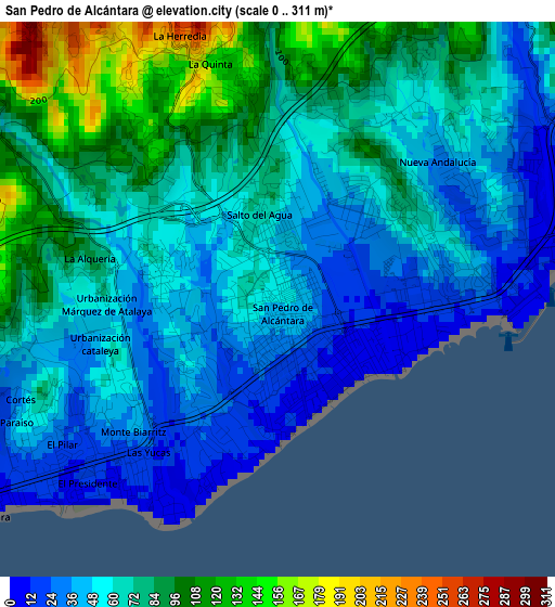
Below is the Elevation map of San Pedro de Alcántara, which displays elevation range with different colors. Scale of the first map is from 0 to 311 m (0 to 1020 ft) with average elevation of 64.2 meters (=211 ft) [note 1]
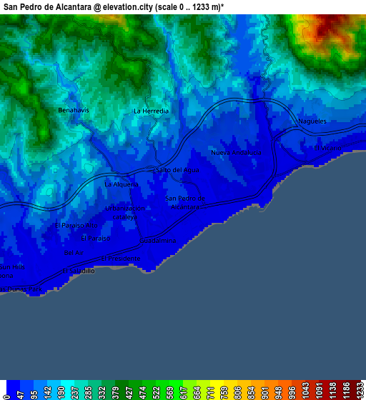
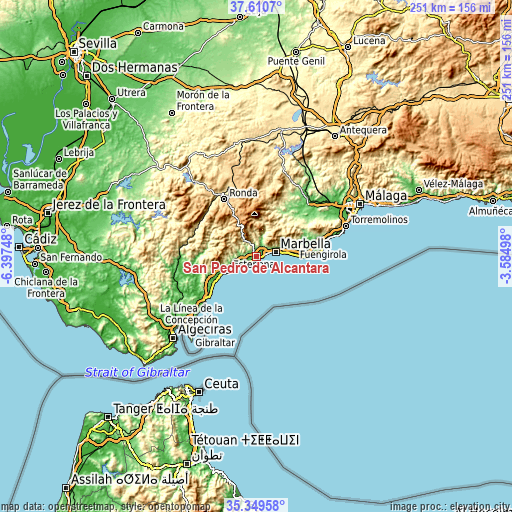
These maps also provides idea of topography and contour of this city, they are displayed at different zoom levels. More info about maps, scale and edge coordinates you can find below images.
| \ | Map #1 | Map #2 | Topo.Map |
| Scale [m] | 0..311 m | 0..1233 m | × |
| Scale [ft] | 0..1020 ft | 0..4045 ft | × |
| Average | 64.2 m = 211 ft | 194.1 m = 637 ft | × |
| Width | 7.86 km = 4.9 mi | 15.71 km = 9.8 mi | 251.4 km = 156.2 mi |
| Height | 7.86 km = 4.9 mi | 15.71 km = 9.8 mi | 251.4 km = 156.2 mi |
| ↑Max Latitude | 36.523713° | 36.55902° | 37.6107° |
| Latitude at center | 36.48839° | 36.48839° | 36.48839° |
| ↓Min Latitude | 36.453051° | 36.417696° | 35.34958° |
| ← Min Longitude | -5.035175° | -5.079121° | -6.39748° |
| Longitude center | -4.99123° | -4.99123° | -4.99123° |
| →Max Longitude | -4.947285° | -4.903339° | -3.58498° |
Nearby cities:
Cities around San Pedro de Alcántara sort by population:
• Marbella elevation 57 m
9.9 km,  72°
72°
• Estepona 13 m
15.4 km,  243°
243°
• Ojén 330 m
14.8 km,  54°
54°
• Benahavís 189 m
6.3 km,  308°
308°
• Monda 365 m
21.2 km,  42°
42°
• Istán 295 m
11.1 km,  19°
19°
• Igualeja 708 m
19.8 km,  323°
323°
• Jubrique 581 m
21.8 km,  292°
292°
• Pujerra 788 m
19.8 km, 314°
• Parauta 802 m
22.4 km,  326°
326°
• Faraján 644 m
22.7 km, 309°
• Júzcar 645 m
22 km, 313°
Multilingual:
 En español:
San Pedro de Alcántara elevación 52 m.
 En France:
San Pedro de Alcántara élévation 52 m.
 Auf Deutsch:
San Pedro de Alcántara höhe über dem Meeresspiegel ist 52 m.
 На русском:
Сан-Педро-де-Алькантара высота над уровнем моря 52 м
Sources and notes:
- [note 1] Map square and city borders are not equal. Map elevation data is calculated only from area inside that square.
- [src 1] Elevation data from geonames database provided with same terms of usage.
- [src 2] The elevation map of San Pedro de Alcántara is generated using elevation data from NASA's 3 arcsec (90m) resolution SRTM data.
- [src 3] Base (background) map © OpenStreetMap contributors tiles are generated by Geofabrik and OpenTopoMap.
Copyright & License:
This San Pedro de Alcántara Elevation Map is licensed under CC BY-SA. You may reuse any part from this page, if you give a proper credit by linking to this URL:
 More info on terms of use page.