Santiago de Calatrava elevation
Santiago de Calatrava (Andalusia, Provincia de Jaén), Spain elevation is 397 meters and Santiago de Calatrava elevation in feet is 1302 ft above sea level [src 1]. Santiago de Calatrava is a seat of a third-order administrative division (feature code) with elevation that is 206 meters (676 ft) smaller than average city elevation in Spain.
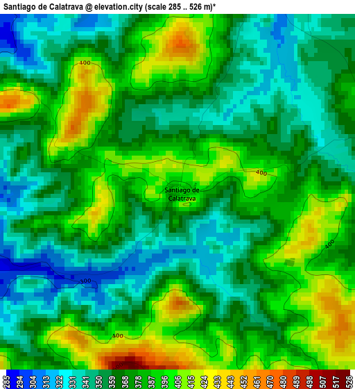
Below is the Elevation map of Santiago de Calatrava, which displays elevation range with different colors. Scale of the first map is from 285 to 526 m (935 to 1726 ft) with average elevation of 371.9 meters (=1220 ft) [note 1]
These maps also provides idea of topography and contour of this city, they are displayed at different zoom levels. More info about maps, scale and edge coordinates you can find below images.
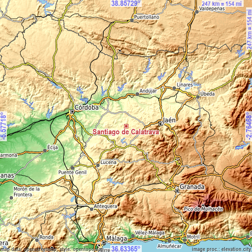
| \ | Map #1 | Topo.Map |
| Scale [m] | 285..526 m | × |
| Scale [ft] | 935..1726 ft | × |
| Average | 371.9 m = 1220 ft | × |
| Width | 7.73 km = 4.8 mi | 247.2 km = 153.6 mi |
| Height | 7.73 km = 4.8 mi | 247.2 km = 153.6 mi |
| ↑Max Latitude | 37.788557° | 38.85729° |
| Latitude at center | 37.75382° | 37.75382° |
| ↓Min Latitude | 37.719067° | 36.63365° |
| ← Min Longitude | -4.214875° | -5.57718° |
| Longitude center | -4.17093° | -4.17093° |
| →Max Longitude | -4.126985° | -2.76468° |
Nearby cities:
Cities around Santiago de Calatrava sort by population:
• Martos elevation 661 m
17.8 km,  101°
101°
• Baena 412 m
20.3 km,  221°
221°
• Torredonjimeno 596 m
18.8 km,  85°
85°
• Alcaudete 672 m
19.7 km,  156°
156°
• Porcuna 472 m
13.1 km,  354°
354°
• Arjona 452 m
22.6 km,  26°
26°
• Lopera 266 m
21.6 km, 349°
• Cañete de las Torres 322 m
18.1 km,  314°
314°
• Valenzuela 327 m
5 km,  299°
299°
• Villardompardo 436 m
17.6 km,  58°
58°
• Escañuela 317 m
18.4 km,  40°
40°
• Higuera de Calatrava 356 m
5.1 km,  13°
13°
Multilingual:
 En español:
Santiago de Calatrava elevación 397 m.
 En France:
Santiago de Calatrava élévation 397 m.
 Auf Deutsch:
Santiago de Calatrava höhe über dem Meeresspiegel ist 397 m.
 На русском:
Santiago de Calatrava высота над уровнем моря 397 м
Sources and notes:
- [note 1] Map square and city borders are not equal. Map elevation data is calculated only from area inside that square.
- [src 1] Elevation data from geonames database provided with same terms of usage.
- [src 2] The elevation map of Santiago de Calatrava is generated using elevation data from NASA's 3 arcsec (90m) resolution SRTM data.
- [src 3] Base (background) map © OpenStreetMap contributors tiles are generated by Geofabrik and OpenTopoMap.
Copyright & License:
This Santiago de Calatrava Elevation Map is licensed under CC BY-SA. You may reuse any part from this page, if you give a proper credit by linking to this URL:
 More info on terms of use page.