Utiel elevation
Utiel (Valencia, Província de València), Spain elevation is 738 meters and Utiel elevation in feet is 2421 ft above sea level [src 1]. Utiel is a seat of a third-order administrative division (feature code) with elevation that is 135 meters (443 ft) bigger than average city elevation in Spain.
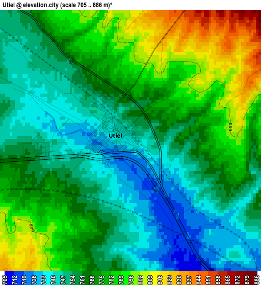
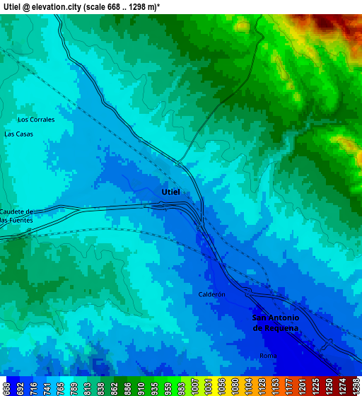
Below is the Elevation map of Utiel, which displays elevation range with different colors. Scale of the first map is from 705 to 886 m (2313 to 2907 ft) with average elevation of 766.5 meters (=2515 ft) [note 1]
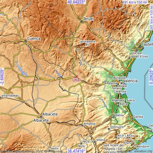
These maps also provides idea of topography and contour of this city, they are displayed at different zoom levels. More info about maps, scale and edge coordinates you can find below images.
| \ | Map #1 | Map #2 | Topo.Map |
| Scale [m] | 705..886 m | 668..1298 m | × |
| Scale [ft] | 2313..2907 ft | 2192..4259 ft | × |
| Average | 766.5 m = 2515 ft | 800.3 m = 2626 ft | × |
| Width | 7.53 km = 4.7 mi | 15.07 km = 9.4 mi | 241.1 km = 149.8 mi |
| Height | 7.53 km = 4.7 mi | 15.07 km = 9.4 mi | 241.1 km = 149.8 mi |
| ↑Max Latitude | 39.600538° | 39.63439° | 40.64223° |
| Latitude at center | 39.56667° | 39.56667° | 39.56667° |
| ↓Min Latitude | 39.532785° | 39.498883° | 38.47416° |
| ← Min Longitude | -1.243945° | -1.287891° | -2.60625° |
| Longitude center | -1.2° | -1.2° | -1.2° |
| →Max Longitude | -1.156055° | -1.112109° | 0.20625° |
Nearby cities:
Cities around Utiel sort by population:
• Requena elevation 699 m
12.2 km,  135°
135°
• Venta del Moro 754 m
15.9 km,  234°
234°
• Camporrobles 919 m
19.5 km,  298°
298°
• Sinarcas 882 m
18.7 km,  351°
351°
• Mira 862 m
26 km,  309°
309°
• Aliaguilla 996 m
22.2 km,  331°
331°
• Caudete de las Fuentes 784 m
6.8 km,  263°
263°
• Fuenterrobles 921 m
13 km,  278°
278°
• Villargordo del Cabriel 856 m
20.3 km, 259°
• Chera 624 m
20.3 km,  79°
79°
• Calles 378 m
26.1 km,  48°
48°
• Benagéber 751 m
18.7 km,  27°
27°
Multilingual:
 En español:
Utiel elevación 738 m.
 En France:
Utiel élévation 738 m.


Sources and notes:
- [note 1] Map square and city borders are not equal. Map elevation data is calculated only from area inside that square.
- [src 1] Elevation data from geonames database provided with same terms of usage.
- [src 2] The elevation map of Utiel is generated using elevation data from NASA's 3 arcsec (90m) resolution SRTM data.
- [src 3] Base (background) map © OpenStreetMap contributors tiles are generated by Geofabrik and OpenTopoMap.
Copyright & License:
This Utiel Elevation Map is licensed under CC BY-SA. You may reuse any part from this page, if you give a proper credit by linking to this URL:
 More info on terms of use page.